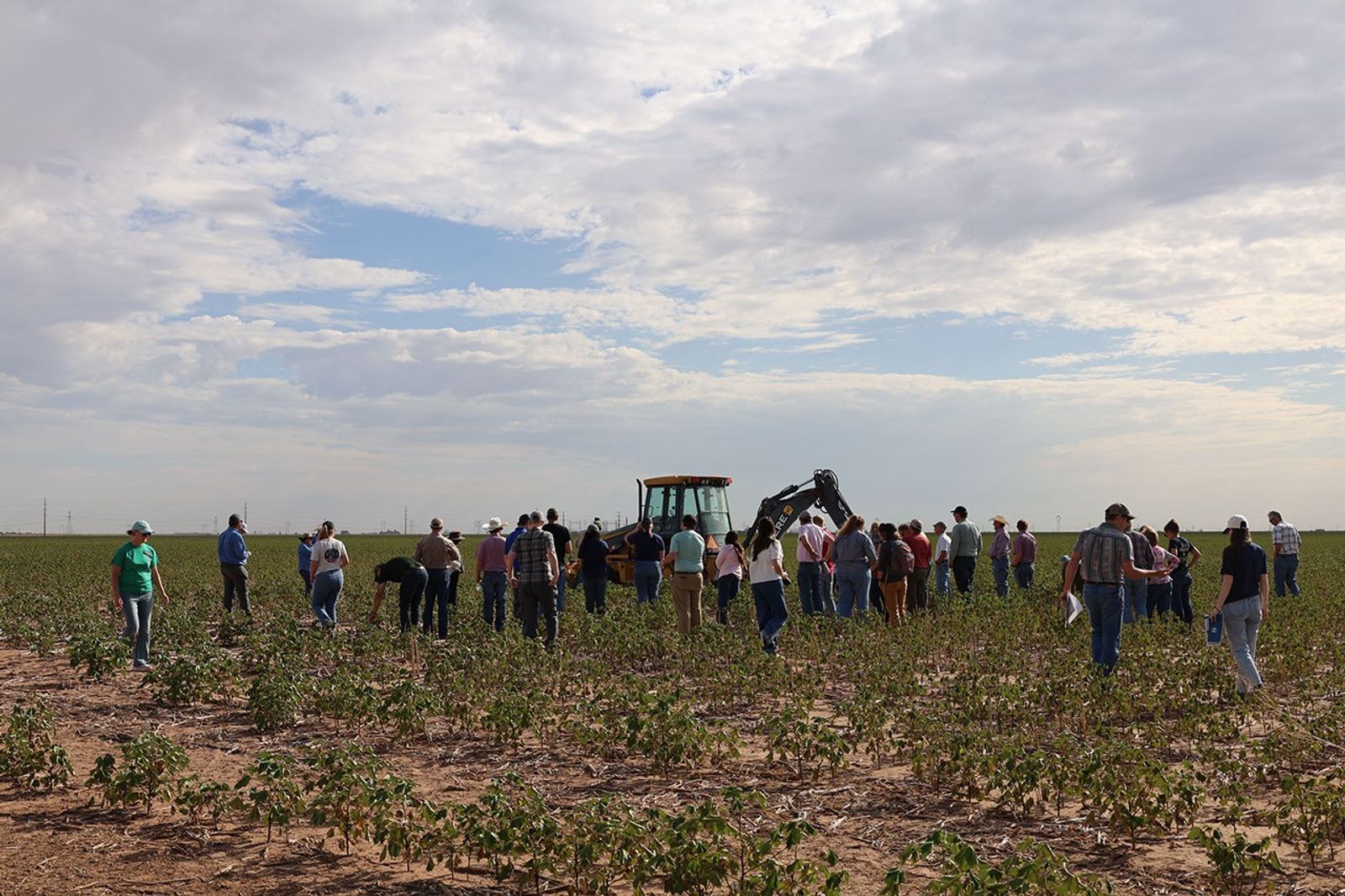
As of 2026-10-09 00:35 UTC. A NASA report published October 8 describes Texas High Plains cotton farmers losing both crops and access to irrigation water during the 2026 drought.[1]
Lubbock County farmer Lacy Cotter-Vardeman told NASA that roughly 90 percent of her dryland cotton was dead and that many irrigation wells stopped working in August. That loss estimate describes her operation; it is not a regional crop assessment.[1]
The stakes extend through the cotton economy. USDA’s sector overview, updated in January 2025, identifies Texas as the largest producing state, with most of its production concentrated in the High Plains. Cotton is ginned and sampled for USDA grading, then usually stored in warehouses before shipment to mills. A smaller harvest therefore affects businesses well beyond the farm gate, although this field report cannot establish the size of those wider losses.[2]
What the records establish
| Record | Finding | Evidence boundary |
|---|---|---|
| NASA, October 8, 2026 | Crop deaths and failing wells.[1] | Farm accounts; no regional loss percentage. |
| Texas Water Development Board aquifer overview | About 95% of water pumped from the Ogallala in Texas serves irrigated agriculture.[3] | Structural background, not a new October measurement. |
| USGS report published February 2024 | The eight-state High Plains aquifer’s average water level fell 16.5 feet from about 1950 to 2019.[4] | Historical, area-weighted average; individual locations vary widely. |
The reserve beneath the crop
The Texas Water Development Board describes a persistent imbalance: across much of the Ogallala, withdrawals exceed recharge, the water entering the aquifer. Irrigation draws on that accumulated underground supply. When pumping repeatedly exceeds replenishment, the reserve available for future dry seasons diminishes.[3]
This gives the current accounts a longer context. USGS calculated a loss of about 286.4 million acre-feet of recoverable storage between predevelopment and 2019 across the entire High Plains aquifer. Yet its shorter 2017–2019 comparison showed a small average water-level rise. Both findings can be true: a brief improvement can occur within a much longer decline.[4]
Those measurements also explain why a single regional number needs care. The USGS study covers parts of eight states, and its well records include rises as well as steep falls. Its 2019 endpoint cannot tell a grower how much water a particular Texas well can supply today. The relevant evidence for that decision must come from the local well and aquifer conditions.[4]
A wetter spell can ease demand for irrigation. Establishing that the underground reserve has recovered requires water-level evidence and a comparison of withdrawals with recharge. Rainfall alone does not settle that question.[3]
Farmers are already changing the operation
NASA Acres’ September account of its August listening tour describes adaptations already underway. At Bingham Family Farms and Vineyards, the family discussed diversifying into wine grapes and moving more acreage toward dryland production as groundwater declined. The report presents those changes as the experience of one operation, rather than a crop prescription for the region.[5]
In Brownfield, the tour brought farmers together with conservation districts, a lender and NASA representatives. Discussions included what information growers could use and what satellite observations could realistically support. At Texas A&M AgriLife’s Lubbock center, researchers discussed field measurements that help make remote observations useful.[5]
The practical implication is that a satellite product earns its place through a farm decision: choosing land use, evaluating conservation or assessing a crop. The tour documents a process for connecting research with those choices. It does not demonstrate a measured reduction in aquifer depletion.[5]
Restoration of playas, the shallow basins scattered across the landscape, addresses another part of the water system. Playa Lakes Joint Venture describes work that removes excess sediment, fills drainage features, restores incoming runoff and establishes native vegetation around a basin. Sediment can reduce how much water a playa holds; a surrounding buffer helps intercept new sediment before it arrives.[6]
The work reaches beyond the basin itself. Roads, terraces and blocked culverts can divert its water supply, sometimes requiring neighboring landowners to cooperate. Restoration therefore involves the surrounding drainage area as well as excavation. These practices can restore recharge functions, but the guidance offers no guarantee that an individual irrigation well will recover on a farmer’s planting schedule.[6]
What comes after the field report
For growers, local lenders and conservation districts, the immediate task is to distinguish the season’s crop damage from the water available for the next one. In the next 24 hours, identify which figures are farm testimony and which are measurements. Over seven days, compare recent rainfall with available local well records. Over 30 days, examine whether proposed land-use or restoration changes have a workable site assessment and funding plan. These are reporting and planning horizons, not deadlines announced by NASA.
Three conditional paths deserve attention. The base case is continued adjustment to limited groundwater while farms assess harvest results. An upside would require sustained moisture improvement accompanied by evidence that local water supplies are stabilizing. A downside would emerge if more wells lose capacity and the area that can be irrigated contracts further. These are scenarios for monitoring, not forecasts of the 2027 crop.
Before carrying a claim into a planting budget or a regional headline:
- Keep farm loss estimates attached to the operation that reported them.
- Date groundwater measurements and identify their geographic coverage.
- Revise recovery claims if local well records fail to show the assumed improvement.
Sources
- Adam Voiland, NASA Earth Observatory, “Fighting Drought in Texas Cotton Country” (October 8, 2026) — farmer accounts and the August 25 Kress photograph by Adam Zwerner/NASA Acres.
- USDA Economic Research Service, “Cotton and Wool — Cotton Sector at a Glance” (updated January 8, 2025) — Texas production geography and the cotton processing chain.
- Texas Water Development Board, “Ogallala Aquifer” (accessed October 9, 2026) — irrigation dependence, withdrawals and recharge.
- Virginia L. McGuire and Kellan R. Strauch, USGS, “Water-level and recoverable water in storage changes, High Plains Aquifer, predevelopment to 2019 and 2017 to 2019” (February 13, 2024) — historical water levels and storage across eight states.
- Adam Zwerner, NASA Acres, “On the Road with the NASA Space4Ag Tour: Listening to Agriculture Across Texas, Oklahoma, and Kansas” (September 16, 2026) — farm adaptations, the Brownfield roundtable and field research.
- Playa Lakes Joint Venture, “Restoring and Maintaining Playas” (accessed October 9, 2026) — sediment removal, buffers, drainage repairs and restoration of water flow.