As of 2026-05-03 11:05 UTC, the White House has granted Bridger Pipeline Expansion LLC a presidential permit to construct, connect, operate, and maintain pipeline border facilities at the U.S.-Canada boundary in Phillips County, Montana.[1] The fastest headline is that Washington approved a major new cross-border oil line. The more accurate one is narrower. The permit opened the border gate. It did not move the rest of the 647-mile project out of the federal-and-state review queue that is still running through BLM, Montana DEQ, and a wider permit stack with milestones extending into 2027.[1][2][3][4][5]
That distinction matters because the White House document is explicit about what it does and does not do. It authorizes the border facilities and says the permit does not displace otherwise applicable laws and regulations.[1] The same permit also says the company must still obtain permits from relevant federal, state, and local authorities.[1] BLM and Montana DEQ, meanwhile, are still describing the project as a route under active scoping and environmental review: a 36-inch buried crude-oil pipeline proposed to move about 550,000 barrels a day from the Canadian border to an existing crude-oil terminal near Guernsey, Wyoming.[2][3][4][5]
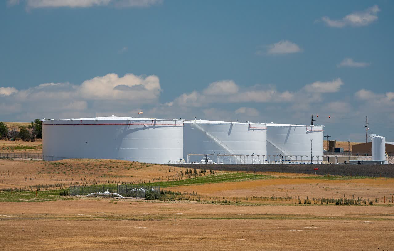
Image context: the cover uses a real photograph of crude-oil tanks near Guernsey, Wyoming.[6] That is the right visual here because the operational center of gravity is not the Oval Office signature alone. It is the physical chain the project is trying to create between the border crossing and downstream storage and transport infrastructure at the Guernsey end.
Fast facts
| Item | What is live now | Confidence note |
|---|---|---|
| White House action | President Trump signed the presidential permit on April 30, 2026.[1] | Strong. Direct from the permit text. |
| What the permit covers | The permit covers the border facilities: a 36-inch pipeline from the international boundary to the first U.S. shut-off valve or pumping station within 2,000 feet of the border.[1] | Strong. This boundary is defined in the permit itself. |
| What it does not do | The permit says it does not displace other applicable laws and regulations, and that the permittee must obtain additional federal, state, and local permits.[1] | Strong. Direct from Articles 2 and 6. |
| Project scale | BLM and Montana DEQ describe a proposed 647-mile, 36-inch buried crude-oil line carrying about 550,000 barrels per day from Phillips County, Montana, to an existing terminal near Guernsey, Wyoming.[2][3][4] | Strong. Repeated across the agencies' current project pages. |
| Review status | BLM's project page still lists the project as In Progress - Public Scoping Period, with an EIS underway.[3][5] | Strong. Direct from the BLM project home page and notice of intent. |
| Federal-land exposure | BLM says only about 64 miles of the proposed route cross BLM-managed public lands, but BLM is still the lead federal agency for the full review.[2] | Strong. Direct from BLM's March 31 announcement. |
| Schedule signal | BLM's current project page shows an initial Final EIS target of April 2, 2027 and an initial Record of Decision target of May 31, 2027.[3] | Strong for the current schedule; environmental review timelines can still move. |
What the White House actually approved
The permit is narrower than a full-route green light. The White House defines the authorized border facilities as the part of the project that runs from the international boundary to the first mainline shut-off valve or pumping station less than 2,000 feet inside the United States.[1] That matters because it means the legal centerpiece of the April 30 action is the cross-border connection itself, not the entire downstream buildout through Montana and Wyoming.
The permit text also gives a clear warning against overreading the signature. It says the action does not affect the applicability of otherwise relevant laws and regulations.[1] It also requires the permittee to obtain the permits and authorizations still needed from relevant authorities.[1] In practical terms, that means the White House has answered one jurisdictional question while leaving the environmental, right-of-way, water, air, transportation, and route-specific questions alive in other channels.[1][5]
There is one more subtle point in the permit text. Article 1 says substantial design changes would require a new permit or amendment, but it also says changes to average daily throughput capacity can be made to any volume achievable through the border facilities.[1] The border authorization is therefore not the same thing as a final operating blueprint for the whole line. It is a gate that makes a cross-border project legally possible while other reviews continue to decide how, where, and under what conditions the rest of it could be built.
Why the real build fight is still in the review queue
BLM and Montana DEQ have already framed the next stage. BLM's March 31 announcement says the agency is the lead federal reviewer even though only about 64 miles cross BLM-managed public lands, because the route also touches private, state, and other federal lands.[2] The project home page says the agency intends to prepare an EIS, with DEQ acting as a joint lead because Montana's Major Facility Siting Act process also requires environmental review under MEPA.[3][5]
That schedule is slow enough to matter. BLM's current project page still places the initial final EIS date on April 2, 2027 and the initial record-of-decision date on May 31, 2027.[3] The federal notice of intent similarly says the scoping process has just begun, with comments on the scope of analysis, alternatives, and relevant information requested during the public-scoping window.[5] A project with a presidential permit in hand but an EIS and record of decision still pointing into 2027 is not shovel-ready in any normal infrastructure sense.[1][3][5]
The federal-register notice also shows how much remains unsettled. BLM says the project would seek a 30-year renewable right-of-way grant, temporary use permits during construction, and a list of additional authorizations ranging from Clean Water Act approvals to state air permits and transportation encroachment permissions.[5] The notice lists eight pump stations and 72 mainline valve sets along the route and says field investigations on wildlife, water, paleontology, historic properties, tribal concerns, and other resource questions are still under way.[5] That is the language of a live environmental file, not a finished permit stack.
Why Guernsey matters more than the headline
The most grounded way to read the project is from its endpoint. BLM and DEQ say the route is designed to move Canadian crude to an existing terminal near Guernsey, Wyoming.[2][3][4][5] The White House permit matters because without the border crossing the project has no international starting point. But the commercial purpose sits farther south, in the infrastructure chain that can receive, store, and redirect crude once it reaches Wyoming.[1][2][3]
That is also why the Guernsey tank-farm image works better than a generic signing-room visual. The project is not being sold as a symbolic U.S.-Canada gesture. In the notice of intent, BLM says the applicant's stated purpose is to transport crude from Canadian production areas to existing infrastructure and downstream markets in the United States.[5] Whatever one thinks of that policy logic, the project's practical question is whether a route from the border to Guernsey can survive environmental review, public comment, and the remaining permit sequence.
BLM's current documents add another useful detail: the proposed route would parallel existing Bridger-owned infrastructure for about 138 miles in Montana and 100 miles in Wyoming.[5] That suggests the company is not trying to drop an entirely isolated corridor onto the map. It is trying to extend and connect into a broader oil-transport system. That may help the applicant argue for operational logic and corridor familiarity. It does not eliminate the review burden around crossings, land use, wildlife, water, tribal concerns, or landowner conflict.[2][5]
Decision impact by horizon
Next 24 hours
Backers of the project can now say the White House has cleared the cross-border segment, which is a real win on one critical jurisdictional piece.[1] Opponents, regulators, and affected communities will shift the argument back to BLM and DEQ, because that is where route alternatives, impact analysis, and mitigation still have room to bite.[2][3][4][5]
Next 7 days
Watch the scoping file, not the ceremonial language. The key operational question is whether agencies treat the April 30 White House action as political pressure to compress review, or whether the line stays on the EIS path BLM has already published.[3][5] Landowners, tribes, county officials, and environmental groups are likely to aim their effort at that stage rather than at the already-signed border permit.[2][4][5]
Next 30 days
The real signal is whether the route exits the current scoping-and-study phase any faster than BLM's own published timeline suggests.[3][5] If no schedule compression appears, the April 30 permit will look important but partial: necessary for the border, insufficient for construction. If Washington and the agencies start accelerating ancillary approvals or narrowing alternatives, then the center of gravity will shift from scoping to litigation and implementation risk.
Scenarios
Base case: The presidential permit stands, but the project remains mostly an environmental-review file through 2026, with the route, mitigation, and terms of federal and state approvals still unresolved.[1][3][5]
Upside case for the applicant: The White House permit helps align agencies, the EIS process stays on BLM's currently published timetable, and the company exits 2027 with the major federal and state approvals it needs to start serious construction planning.[1][3][5]
Downside case: The permit becomes the easy part. Water, wildlife, landowner, tribal, or cumulative-impact disputes widen the review fight, push deadlines out, or drive legal challenges that make the cross-border authorization look politically loud but operationally incomplete.[2][3][4][5]
Action checklist
- If you track U.S. energy infrastructure, separate the border permit from the full-route build approval. They are not the same decision.[1][3][5]
- If your interest is land, water, or route risk, the live file is still the BLM and Montana DEQ review process, not the White House memo by itself.[2][3][4][5]
- If you are modeling schedule, use the currently published 2027 EIS and record-of-decision markers as the serious baseline unless agencies formally change them.[3]
- Invalidation condition: if BLM or DEQ formally compresses the review path, or if a court or agency action interrupts the permit chain, the "border gate first, build queue later" reading would need to be revised quickly.[1][3][5]
Sources
- The White House, "Presidential Permit: Authorizing Bridger Pipeline Expansion LLC to Construct, Connect, Operate, and Maintain Pipeline Facilities at the International Boundary at Phillips County, Montana, Between the United States and Canada" (April 30, 2026).
- Bureau of Land Management, "BLM, Montana DEQ seek initial input for proposed Bridger Pipeline" (March 31, 2026).
- Bureau of Land Management, "Bridger Pipeline Expansion Project" project home page, including EIS status and schedule (accessed May 3, 2026).
- Montana Department of Environmental Quality, "Major Facility Siting Act | Bridger Pipeline Expansion | Public Comment Ends May 1, 2026 | Public Meetings April 14, 15, and 16, 2026" (April 1, 2026).
- Bureau of Land Management, "Intent to Prepare an Environmental Impact Statement for the Proposed Bridger Pipeline Expansion Project, Montana" public-inspection PDF (scheduled for Federal Register publication April 1, 2026).
- Wikimedia Commons, "File:Suncor Energy - Crude Oil Storage Tank Farm - Wyoming (52210918732).jpg" (source page for the article image).