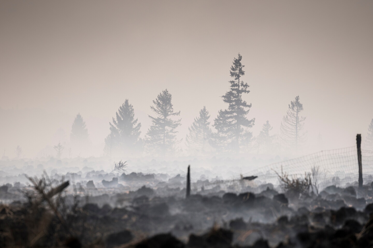
As of 2026-08-17 21:44 UTC, overnight rain and favorable winds had helped limit the overall growth of Belgium's High Fens wildfire, but they had not put it out. Authorities estimated that about 30 square kilometers had burned. Roughly 500 firefighters were working with aircraft from several European countries, while an inaccessible sector remained out of control and was moving toward the German town of Monschau. Precautionary evacuation orders for hundreds of residents were still in force.[1]
That combination—limited overall growth, unresolved active sector—is the key to reading the next update correctly. “No significant growth” describes the fire's total recent change. It does not establish that its outer edge is secure, that heat has left the peat or that evacuated neighborhoods are ready for return.
Three facts also remain provisional. The burned-area estimate can change as mapping improves; no official cause had been established in the reporting available at this timestamp; and none of the cited reporting supplied a comprehensive map of subsurface heat. The fire's surface behavior is visible. Its underground state is much harder to observe.
Image context: the cover photograph was made near Waimes on August 17. It records smoke over a scorched field and damaged trees—the continuing incident, not a generic illustration. A photograph can show that combustion or smoke remains somewhere in the landscape; it cannot show how far heat has traveled through organic soil below the surface.[1]
The Verified Position
| Date or record | What it establishes | What it does not establish |
|---|---|---|
| Wallonia risk notice, August 14 | Vegetation was already dry; the open-land fire risk was rated high, and officials expected only a partial easing from forecast rain. Winds above 35 km/h were identified as an aggravating factor.[3] | It does not identify the ignition source of the High Fens fire. |
| First weekend of the incident | About 600 residents in Waimes and Bütgenbach were told to evacuate. Belgium activated the EU Civil Protection Mechanism as the fire passed the roughly 14-square-kilometer footprint of the High Fens fire in 2011.[2] | An evacuation order does not prove that every home was damaged, and comparison by area is not comparison by severity. |
| Operational report, August 17 | The estimated footprint was about 30 square kilometers; the fire had not grown significantly overall and rain reduced flare-up risk, but an inaccessible sector remained out of control and was moving toward Monschau.[1] | Limited overall growth does not establish a secure perimeter or extinguishment, especially in peat. |
| Belgian preparedness review, 2025 | The Belgian National Crisis Center classifies wildfire as a high-probability risk; the CERAC–NGI review found gaps in dedicated capacity, coordination and consistent national fire data.[6] | A structural warning does not by itself show that the current operation has failed. |
The High Fens are not simply a forest with an unusual name. The protected landscape contains old moorland and peat habitat; the reserve has been protected since 1957 and is described by the region's official tourism service as Wallonia's oldest conservation area.[8] That ecology changes both the suppression problem and the meaning of recovery. A black surface can hide living roots, deep organic fuel or patches that burned at very different intensities.
Why Rain Can Slow Surface Fire Without Ending The Fire
A wildfire can combine two modes of combustion. Flaming fire moves through grasses, shrubs and trees, producing visible flame and a relatively legible edge. Rain can cool those fuels, raise their moisture and make rapid spread less likely. Favorable winds can also stop embers and flame from being pushed into fresh vegetation.
Smoldering fire is different. It is flameless, lower-temperature combustion in an organic fuel such as peat. It can move slowly down or sideways through soil, leave little surface signature and persist after the dramatic flame front has passed. Fire-science research describes ground fire as difficult to locate and suppress because the active zone may be insulated below the surface.[4]
Water does not necessarily reach that zone evenly. Dry or fire-altered organic soil can shed or channel water; a wet surface may sit above a hot pocket, while cracks, roots and variations in peat depth create other pathways. Extinguishing a ground fire can therefore require far more than a rain gauge reading: crews need to find the heat, expose or penetrate the fuel, add enough water, and return to confirm that it has not recovered.[4]
A study of a temperate Scottish peatland documented subsurface smoldering for more than a month despite several episodes of heavy rain.[5] That is mechanism evidence, not a forecast for Belgium. It shows why persistence is physically possible in a cool, wet-region peatland; it does not tell us how long this fire will last. The local evidence is narrower: a High Fens ranger told the Associated Press that new flames had appeared and that underground peat could continue burning for weeks or months.[1] “Could” marks a risk window, not an estimated end date.
The Containment Ladder
One word cannot carry the whole status of a peat fire. A more useful ladder separates four milestones:
- Spread checked: the mapped outer edge holds through the current weather period.
- Surface contained: crews establish control lines and stop open flame or spot fires from escaping them.
- Ground heat cleared: repeated field checks find no actionable hot spots in peat, roots or buried organic material.
- Public access restored: authorities judge roads, utilities, smoke exposure, falling trees and renewed ignition risk safe enough for residents or visitors to return.
The August 17 reporting does not establish the first milestone: it supports only the weaker observation that the fire had shown little overall growth while an inaccessible sector remained out of control.[1] This distinction matters because rainfall can improve surface behavior within hours while a held outer edge requires observation across sectors and weather changes. Clearing ground heat then requires patient detection and mop-up. An official re-entry decision also incorporates hazards that a thermal image alone cannot settle.
The same discipline applies to area figures. “Thirty square kilometers burned” is an incident-footprint estimate, not a claim that every square meter inside it was consumed. Later satellite and ground surveys may find a mosaic of high-severity burn, light surface fire and unburned islands. Until those maps exist, multiplying the headline area into ecological-loss claims would manufacture precision.
What The Response Is Testing
The operation is already multinational. Belgium requested help through the EU Civil Protection Mechanism; current reporting described aircraft or support from Norway, Sweden, Germany and the Netherlands, alongside police drones, local farmers supplying water and Belgian responders.[1][2] The EU's 2026 summer posture includes a shared pool of aircraft, helicopters and pre-positioned firefighters coordinated through its round-the-clock Emergency Response Coordination Centre.[7]
That support addresses surge capacity. It does not erase the domestic questions raised before this fire. The 2025 CERAC and National Geographic Institute review said Belgium lacked a structured, robust national wildfire data system and highlighted fragmented responsibility, limited specialized resources and the need for stronger cross-border collaboration.[6] Those findings should be treated as an audit agenda, not a verdict on the crews in the field.
The most revealing post-incident measures will be mundane:
- how quickly a common perimeter and hot-spot map reached every participating service;
- whether agencies used the same definitions for “contained,” “under control” and “extinguished”;
- how long aircraft, ground crews and water supply could be sustained after visible flames declined;
- whether evacuation and re-entry messages named both the decision and the evidence behind it; and
- whether the final incident record distinguishes footprint, burn severity and confirmed peat involvement.
Publishing those measures would help residents now and improve the national dataset later. Without them, a successful tactical response can still leave the country unable to compare this fire with the next one.
What Changes Over 24 Hours, Seven Days And 30 Days
In the next 24 hours, watch the perimeter rather than the rainfall total alone. The useful signals are new spot fires, wind shifts, renewed smoke columns, changes to evacuation zones and an official description of which sectors remain inaccessible. A single quiet aerial image is weaker evidence than repeated ground and thermal checks across a full weather cycle.
Over the next seven days, the question moves inward. Officials should be able to say whether mapped hot spots are shrinking, stable or reappearing; whether crews can safely reach the interior; and what criteria govern phased return. Trail and reserve closures may reasonably outlast residential restrictions because buried heat, damaged trees and fragile soils create different risks.
Over the next 30 days, the incident should begin to produce a defensible map and review: revised area, burn-severity classes, confirmed structures or habitats affected, response chronology and an account of cross-border deployment. Ecological recovery will take much longer, but the baseline for measuring it should not.
Three Observable Scenarios
- Base case — the perimeter holds while mop-up continues: cooler, wetter conditions keep surface spread limited, residents return in phases, and crews spend days or weeks locating residual heat. The trigger is a stable perimeter plus a documented decline in hot spots—not rain by itself.
- Upside — ground heat contracts quickly: repeated surveys find few deep hot spots, no renewed flame appears through drier or windier periods, and authorities can shorten exclusions without reversing them. The trigger is consistent field evidence across changing weather.
- Downside — concealed heat becomes new surface fire: warmer, drier or windier conditions expose an unsecured edge, smoldering reaches fresh fuel, or access problems prevent crews from treating the interior. The trigger is expanding thermal activity, new smoke or flame outside controlled sectors, or renewed evacuation.
These are conditional paths, not probability estimates. The base case should move upward only when repeated observations show both a held edge and declining ground heat. It should move downward immediately if the mapped perimeter expands or officials restore restrictions they had lifted.
Decision Checklist
- Residents: follow municipal and emergency-service orders, not the apparent weather; verify that a return notice applies to the exact street or village before traveling.
- Officials: timestamp every perimeter and evacuation update, state what “contained” means, and separate surface-fire status from ground-hot-spot status.
- Journalists: label the 30-square-kilometer figure as an estimate, do not infer a cause from the regional warning, and do not translate “not growing significantly” into “out.”
- Land managers: preserve pre-treatment and post-fire observations so later surveys can distinguish emergency damage from suppression work and longer-term ecological change.
- Reviewers: test the 2025 preparedness findings against operational records—mobilization time, interoperable mapping, water logistics, handoffs and data quality—rather than against hindsight.[6]
This assessment should be revised if authorities publish a materially different footprint, declare the fire contained or extinguished under a stated definition, lift or expand evacuations, identify a cause, or release a subsurface heat map. Until then, the most accurate summary is deliberately two-part: rain improved the fire's overall behavior, while an uncontrolled sector and the possibility of underground peat burning keep the all-clear out of reach.
Sources
- Associated Press, “Belgian wildfire approaches Germany as Greece probes deadly blaze” (August 17, 2026) — current footprint, active sector, response, evacuations, peat-fire status and source page for Valentin Bianchi's photograph.
- Associated Press, “Firefighters battle wildfires in Belgium and Greece as 2 die on an island near Athens” (August 16, 2026) — initial evacuations, 2011 comparison and activation of European assistance.
- Wallonia, “Fortes chaleurs et sécheresse = risques d'incendies en milieu naturel” (updated August 14, 2026) — official regional fire-risk, vegetation, wind and rainfall assessment.
- Adam C. Watts and Leda N. Kobziar, “Smoldering Combustion and Ground Fires: Ecological Effects and Multi-Scale Significance,” Fire Ecology 9 (2013) — ground-fire behavior, detection and suppression mechanisms.
- G. Matt Davies et al., “Peat consumption and carbon loss due to smouldering wildfire in a temperate peatland,” NERC Open Research Archive / Forest Ecology and Management (2013) — documented persistence of a temperate peat fire through heavy rain.
- R. W. Kruk et al., Is Belgium ready for more frequent and intense wildfires? Analysis of the Belgian state of play and insights from the international context (CERAC and NGI, February 2025) — national risk, capacity, coordination and data-system assessment.
- European Commission, “EU deploys largest-ever wildfire response for 2026 summer” (June 2, 2026) — Civil Protection Mechanism coordination and shared response capacity.
- East Belgium, “The High Fens” — official background on the protected moorland landscape and reserve.