As of 2026-10-23 03:37 UTC.
Barbuda's new Tsunami Ready status rests on a practical question: when danger is identified offshore, can people on the island get somewhere safer? UNESCO's tsunami programme highlighted the recognition on October 21. The ceremony came earlier: September 24 reporting described the previous day's presentation to the Barbuda Council.[1][2]
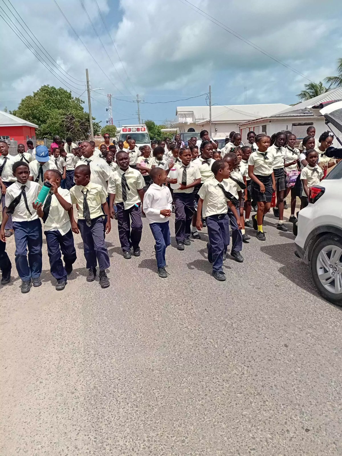
An evacuation exercise initially took participants as far as Louis Hill. Programme representative Christa von Hillebrandt said modelling identified the grounds of Sir McChesney George Secondary School as a closer safe destination for people in that area.[2] The work connected a technical assessment to a journey residents could actually make.
What the recognition establishes
Three points set the limits of the announcement:
- The news date: UNESCO's programme lists its recognition update under October 21, 2026; this is a later account of an earlier ceremony.[1][2]
- The standard: the voluntary programme requires all twelve indicators across assessment, preparedness and response, with recognition renewable every four years.[3]
- The evidence boundary: the designation records completion of preparedness requirements. Measured casualty reduction or independently timed evacuation performance would require additional evidence.[3]
The indicators connect several kinds of work. Communities map hazard zones and estimate who is exposed, prepare evacuation information, and establish response arrangements. They must also provide reliable, redundant ways both to receive official alerts around the clock and to distribute them to the public. Educational activities are required at least three times a year, and a community exercise at least every two years.[3]
That last distinction matters. Receiving an alert at an office and reaching the people who need to act are separate tasks. A functioning connection at the first point does not establish that the second has succeeded.
How a warning reaches the shore
Detection begins with observations. NOAA describes warning centres using seismic information to assess a potential tsunami, then checking water-level networks to establish whether a wave exists and how large it is. Deep-ocean instruments detect pressure changes as the water above them changes; coastal stations measure sea level at particular locations.[4]
Those observations feed forecasts. Models combine incoming measurements with information about the seabed and land surface to estimate arrival times and coastal effects. As evidence develops, warning messages can be revised or cancelled.[4] A forecast is therefore part of an evolving assessment, and an initial message may not be the last word.
UNESCO describes a division of responsibilities across regional, national and local levels. Tsunami service providers evaluate threats and send information to member states. Designated national authorities issue warnings to their own populations and eventually an all-clear. Local preparedness makes an appropriate response possible.[5]
This explains why an island can benefit from regional monitoring while still needing its own practiced arrangements. The international system can supply information; the local system must make that information usable. The questions become concrete: who receives it, who has authority to act, how the message travels, and where people have learned to go.[5]
Why the route needs a rehearsal
Barbuda's preparation included a three-day exercise coordinated by the National Office of Disaster Services. The Antiguan Herald's June 13 account dates the activities to May 26–28, beginning with education at Holy Trinity Primary School and Sir McChesney George Secondary School and ending with an evacuation exercise involving both schools. Officials assessed routes, communications and coordination.[7]
The reported school destination illustrates how modelling and practice can inform a route. The September account attributes the closer option to the programme representative; it does not publish the underlying model or establish that the school is suitable for every possible tsunami.[2]
For residents, the useful information remains the current, locally approved evacuation plan. A news report about one exercise cannot establish a route from every house, workplace or beach. For planners, the question is whether the mapped destination and the journey to it still work together when the plan is rehearsed.
Sometimes the first warning is the sea
Official alerts are only one way people learn of danger. The U.S. National Weather Service identifies strong or prolonged shaking, an unusual change in sea level, or a loud ocean roar as natural warning signs for people in a coastal hazard zone. Its guidance is to protect yourself during shaking, then move to safety as soon as you can, without waiting for an official tsunami warning.[6]
The same guidance warns that the first wave may not be the largest and that danger can continue for hours or days. Returning depends on the authorities' all-clear.[6] This is another reason preparedness requires understanding as well as equipment: people need to recognise both when to begin moving and why an apparently quieter sea may not mean the emergency has ended.
What would show that readiness is lasting?
For schools, accommodation operators and community groups, the immediate task is to connect the recognition to their current instructions. Over the next 24 hours, a useful check is whether the approved plan and responsible contacts are readily available. Over seven days, organisers can identify gaps in staff or visitor briefings. Over 30 days, maintenance records and exercise follow-up would provide evidence of continuing work. These are suggested review intervals, not announced government deadlines.
Three conditional outcomes help interpret that evidence:
- Base case: current plans, working communication arrangements and scheduled practice show that the recognised capability is being maintained.
- Upside: an exercise identifies a specific obstacle, organisers fix it, and a later rehearsal verifies the improvement.
- Downside: an obsolete route or failed warning channel remains unresolved, weakening the practical value of the designation.
The immediate checklist is short:
- Obtain the current evacuation instructions from the responsible local authority.
- Confirm how people needing assistance are included in the plan.
- Check who owns follow-up work after a drill or equipment fault.
An official revision to a hazard map, evacuation destination or warning procedure would invalidate assumptions based on the older arrangement. Barbuda's recognition gives those arrangements a common standard; their continuing usefulness depends on keeping them usable in ordinary community life.
Sources
- UNESCO-IOC Tsunami Programme, “Tsunami risk mitigation and early warning systems,” News & Stories listing — October 21, 2026 announcement of Barbuda's recognition, checked October 23.
- Antigua News Room reporting republished by CARIBPULSE, “Barbuda Recognized as Tsunami Ready Community” (September 24, 2026) — ceremony, school evacuation destination and programme representative's explanation.
- UNESCO-IOC Tsunami Programme, “Tsunami Ready” — twelve recognition indicators, continuing education and exercise requirements, and four-year renewal.
- NOAA, “Detection, Warning, and Forecasting” — seismic and water-level observations, forecast inputs and updates to warning messages.
- UNESCO-IOC Tsunami Programme, “End-to-End Warning Systems” — regional, national and local responsibilities, public warnings and the all-clear.
- U.S. National Weather Service, “During a Tsunami” — natural warning signs, movement after shaking, successive waves and return instructions.
- Antiguan Herald, “Barbuda Edges Closer to Tsunami Ready Status After Three-Day Preparedness Exercise” (June 13, 2026) — May school activities and evacuation exercise; source of the photograph.