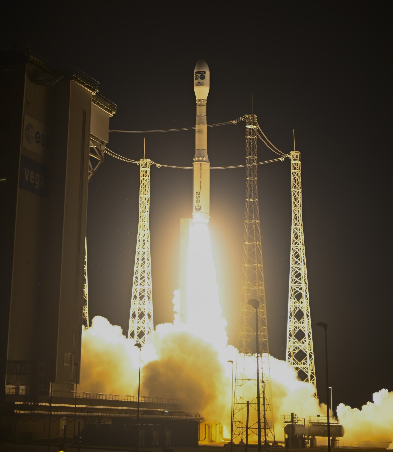
As of 2026-09-16 04:33 UTC, ESA had confirmed that FLEX and Copernicus Sentinel-3C reached orbit on September 15 aboard Vega-C flight VV30. Controllers received signals from both; spacecraft and instrument checks come next.[1]
There is a revealing detail in the flight plan: FLEX's first science partner will be Sentinel-3A, already in orbit. Sentinel-3C, its companion on the rocket, is scheduled to take over that role later.[1] Sharing a launch and sharing an observation are different arrangements.
That distinction captures the mission's significance. FLEX will measure the faint light emitted by vegetation during photosynthesis. Interpreting that light requires another view of the atmosphere and landscape. The scientific advance depends on how well those observations work together.
A green landscape can conceal a slowdown
Ordinary satellite measures of greenness describe the vegetation exposed to sunlight, but colour can lag changes in activity. NASA illustrates the problem with an evergreen forest in winter: trees can remain green while photosynthesis is effectively on hold. Fluorescence offers a way to investigate the activity behind the appearance.[3]
The light comes from chlorophyll. When a plant absorbs sunlight, some energy supports photosynthetic reactions, while some escapes as heat or fluorescence. These competing pathways respond to conditions around the plant. Measuring the emitted light therefore gives researchers evidence about processes that a picture of green leaves cannot fully describe.[4]
It is a consequential opportunity for drought research, where a crop's visible deterioration may arrive after its functioning has changed. But fluorescence is not a universal traffic light. ESA's scientific explanation describes how protective responses to stress can reduce fluorescence, while severe damage to the photosynthetic machinery can increase it. A brighter signal does not always mean a healthier plant.[4]
FLEX also enters an established field. NASA's OCO-2 programme was discussing space-based fluorescence measurements more than a decade ago.[3] The new mission's promise rests on its dedicated instrument and observing design, rather than on discovering that vegetation glows.
The second satellite supplies the missing context
Sentinel-3 contributes measurements of clouds, aerosols and water vapour, together with surface temperature, land cover and other vegetation information. ESA's August preparation report describes these observations as nearly simultaneous with FLEX's, allowing researchers to examine the plant signal alongside the conditions affecting it.[5]
The pairing is built into the data processing. ESA's product specification says the Level-1c product brings measurements from FLEX's FLORIS instrument and two Sentinel-3 instruments onto a common grid. Level-2 products then use models and supporting datasets to convert observations into geophysical quantities.[6]
In practical terms, a measurement of light at the spacecraft must become an estimate of what happened at the vegetation below. Cloud screening and atmospheric correction are part of that work, not optional finishing touches. The German FLEX Project Office's account of the March science workshop describes a processor combining both satellites' observations and explicitly modelling instrumental and atmospheric uncertainty.[7]
The planned change of partner therefore deserves scrutiny. My reading is that continuity depends on the combined measurements: researchers need to distinguish biological change from changes in the observing system. The launch announcement establishes the sequence; the quality of that record remains to be tested.[1][6]
Nine hectares still need evidence from the ground
FLEX is designed to produce monthly global fluorescence maps at 300 by 300 metres resolution. Its orbit has a 27-day repeat cycle, and ESA lists a three-month commissioning phase before the planned 3.5-year mission.[8] These are design and schedule statements, not a declaration that validated global maps are available today.
A 300-metre-square pixel covers nine hectares. That is a substantial patch of ground to compare with a sensor looking at a small area of leaves. Differences within the pixel can matter as much as precision at the measurement point.
The March workshop addressed that mismatch directly. Researchers described combining tower, drone and aircraft observations to connect local measurements with satellite pixels. The workshop account identifies spatial variability in mixed landscapes as a continuing source of uncertainty.[7] A field comparison must represent the area the satellite sees, rather than merely supply an accurate reading somewhere inside it.
There is also a time boundary. ESA specifies that scientific products through Level-2 describe conditions at the observation time.[6] Turning those snapshots into an account of a crop's day, season or eventual yield adds interpretation. Users should expect the validation evidence to explain that step.
The next milestone is confidence in the measurement
The public record currently supports three different levels of certainty:
- September 15 launch report: deployment and first contact are confirmed by ESA; instrument readiness remains under assessment.[1]
- Mission specification, checked September 16: resolution, repeat cycle and commissioning duration are published targets.[8]
- March workshop record: validation methods and known difficulties were discussed before launch; that account cannot establish performance in orbit.[7]
For research teams and agricultural data providers, the next 24 hours are about spacecraft-status updates. Over seven days, useful developments would include instrument checkout and formation-planning information. Over 30 days, calibration progress and clearer data-access arrangements would matter more than a striking first image. These are monitoring horizons, not ESA release promises.
The base case is commissioning continuing within the published plan. An upside case would require released comparisons showing good agreement between satellite products and representative ground measurements. The downside case would be a reported instrument problem, difficulty combining observations or unexplained discrepancies in validation. Those are conditional tests, not forecasts of trouble.
Before treating a FLEX result as actionable, check three things:
- Does the release identify its calibration status, uncertainty and quality flags?
- Does validation cover the vegetation type and spatial scale relevant to the proposed use?
- Is the result an observation at one moment, or a separately tested estimate of a longer-term outcome?
Revise this assessment when ESA publishes commissioning results or changes the tandem plan. A serious instrument or data-combination failure would weaken the expected benefit; successful validation would strengthen it. The launch has delivered the hardware. The next achievement will be showing how reliably its view of a living landscape can be interpreted.
Sources
- European Space Agency, “FLEX and Sentinel-3C launched” (September 15, 2026) — deployment, first contact, checkout and the planned Sentinel-3A-to-3C tandem sequence.
- European Space Agency, “FLEX and Sentinel-3C lift off” (September 15, 2026) — launch photograph and provenance; credit ESA–S. Corvaja.
- NASA Science, “How does your garden glow? NASA's OCO-2 seeks answer” (2014) — why greenness and photosynthetic activity differ, and the earlier fluorescence-observation programme.
- European Space Agency, “Fluorescence” — energy pathways and differing fluorescence responses to stress; accessed September 16, 2026.
- European Space Agency, “ESA's photosynthesis satellite fuelled” (August 20, 2026) — complementary atmospheric and surface measurements from the initial Sentinel-3A pairing.
- European Space Agency, “Data products” — combined instrument measurements, model-based processing and observation-time limits; accessed September 16, 2026.
- German FLEX Project Office, “FLEX Fluorescence Workshop 2026 — Highlights & Insights” (March 31, 2026) — atmospheric correction, validation methods and the mismatch between ground samples and satellite pixels.
- European Space Agency, “Facts and figures” — mapping resolution, repeat cycle, mission duration and planned commissioning; accessed September 16, 2026.