As of 2026-05-02 18:36 UTC, the easy headline on ESA's Celeste mission is that Europe has joined the low-Earth-orbit navigation race.[1][2] The more useful headline is narrower. Europe has now placed the first two Celeste demonstration satellites in orbit, received first navigation signals from both spacecraft, and opened a live test of whether a low-orbit layer can strengthen Galileo rather than distract from it.[1][2][3]
That distinction matters because Celeste is not being pitched as a wholesale Galileo replacement. ESA's own material keeps describing it as a complementary layer for Europe's existing medium-Earth-orbit positioning, navigation, and timing stack.[1][3][4] The strategic question is therefore about resilience, signal geometry, interference resistance, and service design. If Celeste succeeds, Europe gets a second navigation layer closer to Earth with stronger signals and different operating characteristics. If it stalls, the program remains a clever demonstration with little operational consequence.[2][4][5]
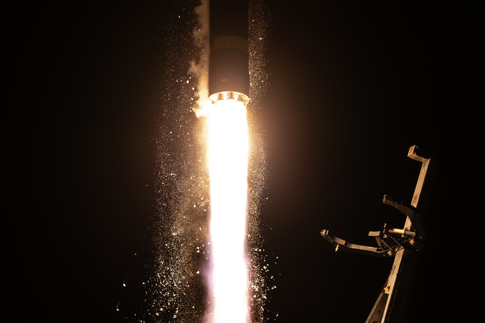
Image context: the cover uses a real Rocket Lab launch photograph distributed through ESA's multimedia library. That is the right visual here because the story has already moved beyond concept art. Hardware has flown, frequencies are being exercised, and the argument now sits in performance proof rather than presentation language.[6]
Fact file
| Item | What is live now | Confidence note |
|---|---|---|
| Launch event | ESA says the first two Celeste in-orbit demonstration satellites launched from New Zealand aboard Rocket Lab's Electron on 28 March 2026 at 10:14 CET.[1] | Strong. Direct from ESA's press release. |
| Immediate mission purpose | ESA says the pair begins testing a complementary low Earth orbit layer for Galileo.[1][3] | Strong. Repeated across the press release and mission background page. |
| First signal milestone | ESA says Celeste IOD-1 transmitted its first navigation signal on 8 April, published on 10 April, and Celeste IOD-2 followed on 17 April.[2] | Strong. Direct from ESA's first-signal story. |
| Signal characteristics | ESA describes the first signal as a dual-frequency navigation message in the L- and S-band, and says this is the first such navigation message sent from a European satellite in low Earth orbit.[2] | Strong. Direct from ESA's story. |
| Program scale | ESA says the first demonstration phase is built around 11 satellites in low Earth orbit.[2][3] | Strong. Appears in the mission story and background page. |
| Core technical rationale | ESA says low-Earth-orbit PNT can provide stronger signals, more geometric diversity, and additional resilience compared with traditional MEO navigation layers.[4] | Strong. Direct from ESA's technical explainer. |
| Policy rationale | The European Commission's radionavigation plan describes resilient future PNT as a multiple-source system rather than a single-layer one.[5] | Strong. Direct from the Commission's JRC summary page. |
What the launch actually changed
The launch did not settle whether Europe needs a full operational LEO navigation constellation. It changed the status of the debate from paper argument to in-orbit evidence. ESA now has two spacecraft from two industrial lines, built respectively by GMV and Thales Alenia Space, working through early operations and commissioning after launch.[1][2][3] That shift matters because the case for low-orbit navigation has always depended on claims that sound attractive in theory: stronger received signals, more favorable geometry in obstructed environments, and new service options if more frequency bands are brought into use.[4]
Before March and April, those claims still lived mostly in concept notes and resilience language. After launch and first signal reception, the Celeste file looks more like an engineering and regulatory sequence. The satellites have to survive commissioning, validate payload behavior, exercise the required L- and S-band filings, and demonstrate that the extra layer really can work in combination with Galileo and the wider European PNT stack.[1][2][3]
That is why it is too loose to describe Celeste as "Europe's answer to Starlink for navigation" or any other simple mega-constellation analogy. ESA is not saying that ordinary Galileo service is being retired or displaced.[1][3][4] The agency is arguing for a multi-layer navigation architecture in which low-Earth-orbit assets can improve robustness and open new service room while medium-Earth-orbit Galileo continues to do the foundational work.[3][4][5]
Why the first signal matters more than the launch photo
The launch was visually dramatic; the first signal is operationally richer. ESA says Celeste IOD-1's transmission was the first dual-frequency navigation message in the L- and S-band sent from a European satellite in low Earth orbit, and that IOD-2 later did the same.[2] That is a more meaningful milestone than liftoff alone because navigation systems are not judged by orbit insertion headlines. They are judged by whether signals, frequencies, timing behavior, and service concepts work reliably enough to support real users and future program decisions.
ESA's technical explanation of LEO-PNT clarifies why this is important. Signals from lower orbit arrive stronger than traditional MEO navigation signals, and the faster motion of low-orbit satellites changes ranging geometry in ways that can improve performance, especially where MEO signals are weakened or blocked by the built environment.[4] The agency also says Celeste is exploring bands and signal structures meant to improve resilience against interference, including jamming and spoofing pressures that have become more salient across Europe.[4][5]
The right reading here is therefore not that Celeste has already solved interference or urban-canyon performance. ESA has not said that, and the mission is still in demonstration mode.[2][3][4] The better reading is that Europe now has a real in-orbit platform for testing those claims. That inference follows from the official material: the mission has crossed the threshold from concept advocacy into measurable system behavior.[1][2][3][4]
The live strategic question
The strongest policy signal in this file comes from the architecture itself. The European Commission's radionavigation plan frames future resilience as a system built from multiple positioning and timing sources rather than one perfectly protected satellite layer.[5] Celeste fits that logic closely. It is valuable not because it makes Galileo obsolete, but because it offers Europe another lane when the old single-layer assumption looks too fragile.
That matters for two reasons. First, Europe's existing dependence on satellite navigation is now deep enough that robustness is not a luxury feature. Smartphones, transport, timing-dependent infrastructure, and other sectors already sit on this stack.[3][5] Second, resilience has become a security and continuity question as much as a convenience question. ESA's own material explicitly ties Celeste to stronger signals, additional frequency options, and a design path better suited to a contested or degraded signal environment.[2][4]
The risk is familiar to any public-technology program. Demonstration missions can prove enough to justify speeches without proving enough to justify scaled operations. Celeste avoids that trap only if the in-orbit data turn into a credible follow-on case for the preparatory and eventually operational phases that ESA and Member States have already sketched.[1][2][3] That is an inference from the source trail, but it is the operational inference that matters now.
What to watch next
Over the next 30 days, the most important signals are technical rather than rhetorical. Watch for more evidence from ESA on payload health, signal validation, and commissioning progress across the first pair of spacecraft.[2][3]
Over the next 90 days, the question broadens from "did the satellites work?" to "what did they prove that Galileo alone cannot do as well?" The answer has to sit in concrete resilience, availability, accuracy, or service-capability gains rather than in generic language about innovation.[3][4][5]
Over the next program phase, the real decision point is whether Celeste stays a demonstration or becomes a durable layer in Europe's navigation architecture. ESA says the 11-satellite in-orbit demonstration is already linked to a larger preparatory phase and to the agency's resilience agenda.[2][3] If the data are strong, the case for a complementary LEO layer hardens. If the data remain ambiguous, Galileo will keep its central role without a convincing low-orbit partner.
The cleanest bottom line is this: Celeste's first signals have made Europe's LEO navigation idea real enough to test and still too early to celebrate as infrastructure. The live story is no longer whether launch could happen. It is whether the first in-orbit proof can mature into a second navigation layer that actually changes European resilience, service design, and strategic autonomy.[1][2][3][4][5]
Sources
- European Space Agency, "Celeste's first satellites launched to explore LEO-based satellite navigation" (28 March 2026).
- European Space Agency, "ESA's Celeste broadcasts first navigation signal from low Earth orbit" (10 April 2026; updated 17 April 2026).
- European Space Agency, "Introducing Celeste" (accessed May 2, 2026).
- European Space Agency, "Benefits of satellite navigation in low Earth orbit" (accessed May 2, 2026).
- European Commission Joint Research Centre, "The European Radionavigation Plan and the future of navigation" (23 January 2024).
- European Space Agency Multimedia, "Rocket Lab's Electron rocket lifts off carrying Celeste" (image source page, March 2026).