On Sunday, May 22, 1960, the earth began moving beneath southern Chile at 3:11 p.m. The magnitude 9.5 Valdivia earthquake wrecked towns, lowered stretches of coast, and launched a Pacific-wide tsunami. It also created a second emergency inland. About 65 kilometers east of Valdivia, three landslides fell across the outlet of Lake Riñihue and blocked the San Pedro River. Water kept entering the lake system; its exit had become a wall of saturated earth.[1][2][3]
The response is usually remembered as the operation that “saved Valdivia.” That is true, but the verb can hide the harder achievement. The water was not stopped. Between July 24 and 26, it still descended the San Pedro and Calle-Calle rivers, entered riverside settlements, and raised the water in Valdivia by roughly two meters. Operation Riñihue succeeded because it changed how the flood arrived: from a sudden breach that could tear open its own channel into a slower release shaped by cuts, temporary barriers, warnings, and evacuation.[2][4][5]
This is the sharper question behind the Riñihuazo: how do you manage a disaster whose final act cannot be canceled?
May 22: three new dams and a rising lake
The landslides were not three tidy heaps. In a 1963 geological study, Stanley N. Davis and Juan Karzulović estimated that the largest displaced about 30 million cubic meters of unconsolidated sediment, the next about 6 million, and the smallest about 2 million. They had fallen where older slide scars already marked an unstable landscape. The quake did not invent the weakness; it mobilized it at enormous scale.[3]
Engineers and officials called the obstructions tacos—plugs—and numbered them one through three. The largest, Taco 3, lay downstream. A technical account read into the Chilean Senate on August 2, 1960, described it as roughly 800 meters across and 1,300 meters long along the river’s line. If rising water simply overtopped this loose material, rapid erosion could unzip the whole barrier. The lake would not merely spill. It could manufacture a much larger flood by destroying its own temporary dam.[4]
The arithmetic made waiting impossible. A University of Chile history of the operation estimates that the lake rose by about half a meter on an average day and that each additional meter represented roughly 20 million cubic meters of stored water. More than 100,000 people lived in the threatened corridor. The emergency therefore ran on two clocks: the water rose continuously while every road, survey, camp, and channel took time to create.[2]
Within hours, Edgardo Palma, the engineer in charge at Endesa’s nearby Pullinque works, received word that Riñihue was climbing and contacted the company’s management in Santiago. Engineers traveled south to verify the obstruction. President Jorge Alessandri’s government placed the emergency plan under institutions that could assemble hydraulic expertise, labor, transport, and equipment: Endesa, Corfo, the Ministry of Public Works, the armed forces, contractors, firefighters, and local volunteers. Raúl Sáez, Endesa’s general manager, became the best-known leader, but the operation was never the work of one man.[2][4]
The plan was to control erosion, not defeat water
The first survey turned a dramatic threat into a sequence of earthworks. Chilean Air Force photographs helped engineers draw a plan of terrain that had just changed shape. The crews would cut through Tacos 1 and 2. At the largest obstruction, however, they would route a channel through comparatively undisturbed ground around the slide rather than invite the lake to bite directly into the entire unstable mass.[4]
That choice explains the operation better than its heroic nickname does. The objective was not to open the fastest possible exit. Speed without control was the danger. The new path had to admit enough water to stop the lake’s relentless rise while resisting the kind of runaway scour that could widen a small overflow into a violent breach. Downstream, another Public Works team built an artificial barrier—sometimes called Taco 4—to help moderate the eventual surge. Crews also restricted tributaries feeding the lake system, buying more time at Riñihue by holding water elsewhere.[2][4]
Emergency engineering expanded far beyond the outlet. Several dozen kilometers of road had to be repaired and new access cut before machines and workers could reach the site. At first, some crews spent three hours traveling in each direction for a ten-hour shift. Camps and lighting later made continuous work possible in three eight-hour rotations. Vehicles, radios, aerial photography, food, and replacement equipment were as integral to the channel as the men digging it.[4]
Then winter rain changed the method.
When the bulldozers sank, the shovels moved
Twenty-seven bulldozers and tractors were assigned to the works, but abundant rain turned the slide debris into deep, adhesive mud. Heavy equipment bogged down or became unsafe. The plan remained; its means became human. More than 450 workers cut stepped channels with picks and shovels, passed material hand to hand, and reinforced sandy sections with timber so the first flow would follow the intended route.[2]
Later oral histories preserve the physical scale that institutional summaries smooth away. Residents remembered workers arriving from Riñihue, nearby estates, public agencies, and distant projects; they remembered machines failing in the mud and lines of people transferring shovelfuls because one person could not carry the sticky earth far enough alone. They also remembered work continuing by day and night. These accounts do not replace the engineering record. They reveal the bodies and local knowledge inside its verbs: cut, divert, measure, warn.[5]
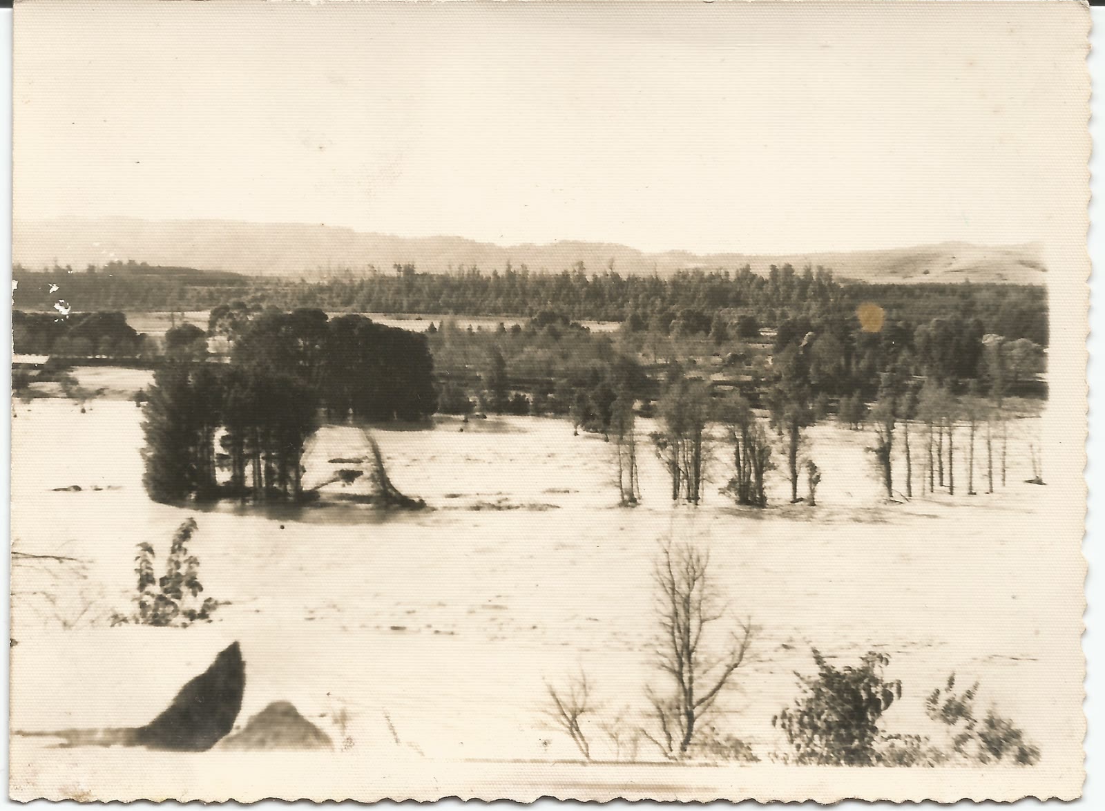
The photograph accompanying this article refuses the familiar heroic image of men at shovels. Taken along the San Pedro in July, it shows water spread across fields among half-submerged trees. That is the operation’s honest visual record: success looked like a flood—just one with a reduced peak and time for people below to move.[6]
Downstream, the radio became a river gauge
For the communities below, the Riñihuazo was an extended wait after an earthquake had already dismantled ordinary life. Newspapers and radio bulletins reported the lake’s level and the progress at the plugs. One oral-history participant recalled that radio announcements supplied daily measurements; others remembered moving uphill, storing possessions above ground level, or leaving low houses when authorities ordered evacuation. Information did not remove the water. It converted an unknown arrival into something people could prepare to meet.[4][5]
That distinction matters because “saved” does not mean “untouched.” Families in Los Lagos, Antilhue, Collico, and other low areas left homes and fields. The oral histories describe water inside houses and thick layers of mud after it receded. Some residents tied structures down or returned to shovel out rooms. The controlled flood still damaged property, crops, roads, and livelihoods. Its human cost cannot be erased by comparing it with the worse catastrophe that did not occur.[5]
Contemporary sources also mark the release with different thresholds. Davis and Karzulović describe water beginning to discharge through artificial canals in the last week of June, after the lake had risen 26.5 meters. Chilean public histories identify July 24–26 as the decisive controlled outflow. Those dates describe stages rather than one ceremonial opening: initial water entered the engineered route, crews kept shaping it, and the passage enlarged until the stored lake produced the main downstream flood.[1][2][3]
July 24–26: the flood arrives by design
After 63 days by the University of Chile’s count, the enlarged channel carried the main release. Its history gives a peak flow of about 7,450 cubic meters per second and describes a gradual rise of around two meters in Valdivia. The Senate account, delivered days later, used a slightly longer operational clock: 68 days until the Calle-Calle had fallen to little more than a winter high. It counted six days of flooding and measured Valdivia’s rise at 2.1 meters.[2][4]
The differing endpoints are instructive. An emergency does not end at a ribbon-cutting moment. It ends differently for the engineer watching the lake begin to drain, the official waiting for the river to fall, and the family returning to a mud-filled house. Operation Riñihue was a chain of partial successes: slowing inflow, opening a route, preventing runaway erosion, broadcasting the approach, moving people, and then enduring the flood that remained.[4][5]
By August 2, senators were already turning the operation into a national story of technical competence and collective sacrifice. That recognition was deserved. But the cleanest lesson is less romantic and more useful. The crews did not overpower a lake. They accepted that gravity would win and redesigned the terms of its victory.[4]
The Riñihuazo became survivable because the response joined geology to logistics and hydraulics to public warning. Aerial photographs made altered ground legible. Stable cuts disciplined erosion. Temporary barriers purchased hours and days. Shovels replaced machines when the mud demanded it. Radios extended the worksite downstream into kitchens and evacuation routes. Success was not dry streets. It was a flood slow enough to announce, channel, and outlive.
Sources
- Memoria Chilena, Biblioteca Nacional de Chile, “Terremoto del 22 de mayo de 1960, Valdivia” — official overview of the earthquake, blocked San Pedro outlet, national attention, and July 24 breakthrough.
- Universidad de Chile, “Operación Riñihue: Los héroes de ayer y hoy” (August 9, 2023; originally published in Revista Beauchef, 2010) — institutions, personnel, earthworks, lake rise, and controlled-release figures.
- Stanley N. Davis and Juan Karzulović K., “Landslides at Lago Riñihue, Chile,” Bulletin of the Seismological Society of America 53, no. 6 (1963), DOI 10.1785/BSSA0530061403 — CiNii institutional record and abstract for the geological survey of the three landslides and lake-level rise.
- Biblioteca del Congreso Nacional de Chile, Diario de Sesiones del Senado, session of August 2, 1960, pp. 1240–1242 — near-contemporary account of the plan, access, shifts, rainfall, communications, and flood duration.
- Museo de Sitio Castillo de Niebla, Riñihuazo: memorias de un desastre (2018) — institutional oral-history study of work at the plugs, warnings, evacuation, flooding, and cleanup along the San Pedro–Calle-Calle corridor.
- Archivo Nacional de Chile, Memorias del Siglo XX, “Desborde del río San Pedro” — catalog page for the July 1960 archival photograph used as the article image, documenting the controlled flooding below Lake Riñihue.