The Erie Canal is easy to remember as an act of nineteenth-century bravado: DeWitt Clinton's ditch, 363 miles of excavation, a ceremonial opening in 1825, and a burst of national self-congratulation.[1][2][4] That story is true, yet it still leaves the canal too monumental and too still. The sharper historical question is why this one waterway changed the American map so quickly and so durably. The answer is less romantic and more mechanical. The canal mattered because it made bulk transport cheap, regular, and legible enough that entire regional economies could be reorganized around it.[1][2][3]
That is the mechanism this article follows. The canal did not create western grain, timber, or migration out of thin air. It changed what it cost, and how long it took, to move them through New York.[1][2][3] Once that happened, city growth, warehousing, trade finance, and rival state responses began to line up behind the same corridor. The Erie Canal therefore belongs in history not only as a feat of digging, but as a machine for compressing freight friction.
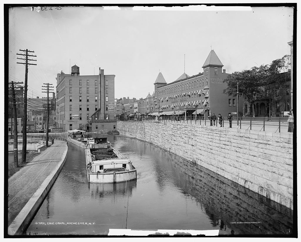
Image context: the cover uses a Library of Congress photograph of the Erie Canal in Rochester made between 1900 and 1906. It fits this essay because the main claim is about repetition. The canal changed history by becoming ordinary infrastructure that could keep carrying barges, goods, and urban growth long after the opening celebrations were over.[6]
Timeline anchors
- July 4, 1817: construction begins on the original Erie Canal after years of argument over route, cost, and feasibility.[1][4]
- October 26, 1825: the canal officially opens from Albany to Buffalo, linking the Hudson corridor to Lake Erie.[1][4]
- c. 1820 to c. 1850: Erie Canalway's published comparisons show freight from Albany to Buffalo falling from about $100 to $10 per ton, while travel time falls from 14 days to 6.[3]
- 1826: Pennsylvania authorizes its own Main Line of Public Works after New York's route begins pulling trade northward.[5]
- 1835 to 1862: New York enlarges the canal; boat capacity rises from 30 tons on the original canal to 240 tons on the enlarged system.[1][2]
1) The canal worked because geography gave New York one usable hinge
The Erie Canal's first advantage was geographic, not ideological. Erie Canalway's teaching materials describe the Mohawk River Valley as the best natural break in the Appalachian barrier between the Atlantic seaboard and the continental interior.[2] Long before canal construction, Indigenous peoples used this water route to connect the Great Lakes world to the Hudson corridor.[2] New York's canal builders did not invent the passage; they formalized and deepened an already meaningful corridor.
That point matters because the canal's impact came from reducing one specific national bottleneck. Moving bulky goods over rough roads or across multiple broken river systems consumed time, animals, labor, and money. The canal replaced much of that fractured overland effort with one continuous water route from Buffalo to Albany and then onward to New York City.[1][2] Once the route became stable, the state had something more valuable than a ditch. It had a repeatable inland hinge between the Great Lakes and the Atlantic.
Erie Canalway's short history notes that the original canal was 363 miles long, 4 feet deep, and 40 feet wide.[1] Those dimensions sound modest beside later infrastructure. Their importance lay in what they standardized. A shipper no longer had to improvise across each county. The route, depth, lock system, and towpath created one shared transport grammar across the state.
2) Price and time compression turned movement into a market revolution
The second mechanism was the collapse of freight friction. Erie Canalway's published comparison chart gives the core numbers cleanly: by about 1850, the cost of moving a ton of freight from Albany to Buffalo had fallen from about $100 to $10, and the trip had shortened from 14 days to 6.[3] Even if one treats those figures as rounded teaching numbers, the directional force is unmistakable. The canal made bulk shipping cheap enough to become normal rather than exceptional.
This is why the canal changed more than transportation. Once grain, flour, lumber, and other heavy goods could move at lower cost and greater regularity, whole categories of economic behavior became easier to sustain.[1][4] The New York State Museum describes the result in broad form: the opening of the canal unlocked the western interior for trade and settlement, boomtowns appeared along the route, and New York City, joined to the Hudson, rose into the country's most powerful center of international trade.[4]
Erie Canalway's grain-transport note sharpens the same point with commodity logic. Grain formed the base of everyday food consumption, and the canal offered a cheap and reliable way to bring wheat, flour, and lumber to growing markets.[7] Reliability is the key word here. Markets do not scale on low cost alone. They scale when merchants, warehouse owners, millers, and city buyers can expect a route to function repeatedly enough to build routines around it.
3) Capacity mattered because the canal kept being rebuilt for more tonnage
The canal's success did not freeze it in place. It forced enlargement. Erie Canalway's materials show the generational jump clearly: the original Erie Canal's boats carried about 30 tons, while the enlarged canal that emerged through the 1835-1862 rebuilding carried about 240 tons.[2] A route that works once can attract traffic; a route that scales can restructure a region.
That scaling explains why the Erie Canal should be read as a system of continual adjustment rather than as a single heroic build. Erie Canalway's brief history says New York widened and deepened the canal three times after 1825 to accommodate larger boats and heavier traffic.[1] The canal did not merely succeed because it was built. It succeeded because the state kept translating commercial success into larger carrying capacity.
The New York State Museum's exhibition page offers one useful object-level clue: a warehouse windlass used from 1831 through 1866 in the village of Mohawk to lift and lower cargo with minimal labor.[4] That artifact sits slightly offstage from the canal itself, but it belongs to the mechanism. Cheap water transport generated a second layer of canal-side handling equipment, storage habits, and labor organization. The canal was not only a line on a map. It was an ecosystem of loading, unloading, warehousing, and city-making.
4) Rival states reacted because the canal reordered national direction
The best proof of the canal's force is how quickly competitors moved in response. The Allegheny Portage Railroad page from the National Park Service states the sequence plainly: in the early nineteenth century, travel from Philadelphia to Pittsburgh by wagon could take 23 days in good conditions, but once New York's canal made trade more efficient, Pennsylvania's trading position dropped enough that the legislature authorized its own public-works system in 1826.[5]
This response shows what the Erie Canal had actually done. It did not simply enrich New York in isolation. It redirected commercial gravity. States to the south understood that the issue was not civic pride but route capture. Erie Canalway's unigrid makes the same point from the New York side: other canals in Pennsylvania, Maryland, and Virginia tried to capture Erie Canal trade, but lacked the same topographical advantage, and most were unfinished or financially weak.[8]
That is why the urban numbers in Erie Canalway's comparison sheet matter. Between c. 1820 and c. 1850, Rochester rises from 1,502 to 36,403, while Buffalo rises from 2,095 to 42,261.[3] Those are not decorative growth figures. They show the canal turning intermediate nodes into cities by feeding them traffic, storage, milling, repair, and exchange.
The bounded conclusion
The Erie Canal changed the map because it made one route dependable enough to absorb whole categories of movement.[1][2][3] Geography gave New York a usable corridor; state building made it navigable; low costs and shorter travel times made it commercially irresistible; enlargement made it scalable; and rival states confirmed its power by scrambling to answer it.[1][2][4][5][8]
There is still a necessary boundary around the triumphal story. Erie Canalway's own history notes that the canal's gains sat alongside the dispossession of Indigenous peoples and the exploitation of immigrant labor under harsh conditions.[1] The canal helped build markets, cities, and a national economy. It also redistributed power through land seizure and unequal work. That harder context belongs inside the same history. The Erie Canal was a transport revolution, and like most revolutions in infrastructure, it changed winners and losers at the same time.
Sources
- Erie Canalway National Heritage Corridor, A Brief History of the Erie Canal - 1817-1825 construction dates, 363-mile route, reduced freight costs and travel times, later enlargements, and the canal's labor and dispossession boundaries.
- Erie Canalway National Heritage Corridor, Canal 3D Tours: Erie Canal History - the Mohawk Valley corridor, freight-cost cuts of up to 90%, New York City's rise past New Orleans, and the shift from 30-ton to 240-ton canal capacity.
- Erie Canalway National Heritage Corridor, Ticket to Ride: The Erie Canal - Growing Our State and Nation - comparison chart for Albany-Buffalo freight cost, travel time, and city-population growth between c. 1820 and c. 1850.
- New York State Museum, "Enterprising Waters: New York's Erie Canal (Phase Two)" - on the 1825 opening, western trade, New York City's harbor advantage, and canal-side warehousing infrastructure.
- National Park Service, "Allegheny Portage Railroad" - on pre-canal overland travel time, Pennsylvania's 1826 response, and the competitive pressure created by New York's canal route.
- Library of Congress, "Erie Canal, Rochester, N.Y." - source page for the photograph used as this article's cover image.
- New York State Museum, "Transporting Grains on the Erie Canal" - on why grain, flour, and lumber dominated canal tonnage and on the rough drop from $100 to $10 per ton for wheat shipping between Buffalo and New York City.
- Erie Canalway National Heritage Corridor, A Water Route to National Unity and World Trade - on the original canal's dimensions and why rival canal systems in neighboring states struggled to capture Erie Canal trade.