Manila is easy to flatten into traffic, malls, churches, and food stops. The Pasig River Ferry changes the read because it makes the old city arrive by water. Use it as a ritual, not as a guaranteed shortcut: check the operating day, show up before the boat you want, ride with commuter patience, then let Escolta and the esplanade slow the downtown handoff.
The tight version has two anchors. The first is the Pasig River Ferry between Guadalupe, Hulo, Lawton, Quinta, and Escolta. The second is the river-edge walk around Escolta, Plaza Mexico, Jones Bridge, and the newer Pasig River Esplanade. Everything else is optional. If you turn this into "ferry plus every Intramuros and Binondo stop," the route loses the point: Manila's old commercial spine is clearer when the river sets the pace.
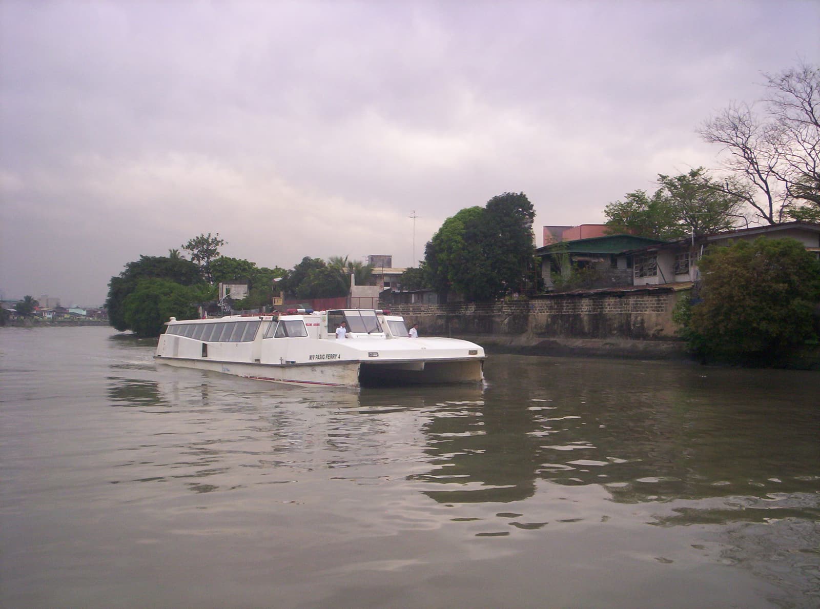
Start by checking whether the ferry is actually running that day. The Metropolitan Manila Development Authority's ferry service had a scheduled maintenance suspension from April 1 to April 5, 2026, with regular operations due to resume on April 6, and the advisory listed the corridor from Guadalupe through Hulo, Lambingan, PUP, Quinta, Lawton, and Escolta in both directions [1]. That is the right mental model: this is a public service with maintenance days, weather exposure, and operating advisories, not a private sightseeing boat that waits for you.
There is current-service texture too: on May 14, 2026, DICT and MMDA launched free public Wi-Fi for ferry passengers, a small but useful sign that the route is being treated as live commuter infrastructure rather than a dormant heritage idea [2].
The most useful first move is to target the mid-afternoon handoff into old Manila. PIA's April 2026 notice listed morning trips at 7:00, 7:30, 8:30, 10:30, and 11:31, then afternoon trips at 12:30, 2:30, 3:30, and 4:15 [1]. Use those numbers as a planning discipline, then verify the live schedule before leaving. If you are coming from Makati or the MRT, Travel Up's local guide notes that Guadalupe Ferry Station is about a 5- to 8-minute walk from Guadalupe MRT, and its ride test from Guadalupe to Escolta took 56 minutes with a minor delay [3]. That is long enough to be a city-reading ride, not just a transfer.
Arrive early and carry ID. A recent local rider report from March 2026 described the service as free at the time, first-come, requiring ID, and prone to filling before the desired departure; the rider arrived at 3:50 p.m. for a planned 4 p.m. boat, missed it because it was full, and waited for the next trip [5]. Build that into the ritual. Show up 20 to 30 minutes early if the boat matters, and never plan dinner, a tour, or a flight connection around the last feasible departure.
The spend range is low, but the backup budget matters. Treat the ferry itself as PHP 0 if the current free-service condition still holds, then keep PHP 100 to 300 in small bills or on a local payment setup for a jeepney, LRT, snack, or taxi fallback if the boat fills, breaks schedule, or stops for weather. This is one of the common visitor mistakes: seeing "free" and assuming "frictionless." The better alternative is to treat free fare as a bonus and timetable uncertainty as the price.
Sit or stand for the river, not for a perfect photo. The cabin and windows change by boat, and parts of the Pasig still show the hard truth of the city: trash, drainage mouths, barge traffic, and industrial edges. The same March 2026 local report called the ride generally okay while noting visible garbage, occasional smell, and an MMDA personnel briefing on board [5]. That is not a reason to skip it; it is a reason to stop expecting a sanitized cruise. Manila's river is both infrastructure and unfinished rehabilitation project.
There is also a camera rule visitors miss. The local rider report says passengers were told not to use cameras while passing Malacanang [5]. Whether the exact instruction varies by crew or security condition, the move is simple: when staff say put the camera down, put it down immediately. A better river ritual is to watch the bridges, revetments, ferries, and station landings with your eyes rather than trying to document every minute.
Escolta is the right arrival because it keeps the river and old downtown in the same frame. iDiscover's Binondo walk places the Escolta River Ferry at Muelle del Banco Nacional and Yuchengco Street, describes it as the Pasig River's water-based transport link in a city otherwise dominated by train, bus, and jeepney habits, and folds it into the old trade corridor around Binondo and Escolta [6]. That historical texture matters. The Pasig was not a scenic accessory to Manila; it was the commercial route that made this edge of the city legible.
Do not rush straight from the pier into Binondo food traffic. The better move is to step out, orient by the bridge and river wall, then give the esplanade its own 30 to 45 minutes. TopGear Philippines reported in April 2026 that nearly 2 kilometers of the Pasig River Esplanade were open between Fort Santiago and Arroceros Forest Park, with a 1.7-kilometer motor-vehicle-free stretch for walking, jogging, biking, and riverside hanging out [4]. Its practical advice is also useful: late afternoon around 4 to 5 p.m. beats heat and sets up sunset, while kiosks and commercial areas generally operate from 3 p.m. to midnight [4].
That gives the cleanest sequence: ferry first, esplanade second, food or Intramuros third. If you reverse it and make the ferry the afterthought, you end up racing the schedule from the wrong side of the day. If you start at the river, the city opens in layers: boat wake, station, old bank buildings, Jones Bridge, Binondo edge, Intramuros wall, then the evening crowd using the esplanade like a public room.
Three traplines catch most non-locals. First, they treat the ferry as an on-demand tourist cruise; the better alternative is to check MMDA/PRFS updates and arrive early with a backup route [1][5]. Second, they board expecting the Pasig to look like a cleaned-up postcard; the better alternative is to accept the smell, debris, and working-river edges as part of the current city condition while still supporting the route's public-transport value [5][7]. Third, they drive to the river edge and spend the good light solving parking; the better alternative is to use LRT, MRT, ferry, or a short walk, because the esplanade itself is best experienced without a car handoff [3][4].
The local moves are small but decisive. Check the ferry page or current advisories before leaving. Choose one direction, preferably into Escolta, instead of trying to ride out and back on thin headways. Carry ID. Arrive 20 to 30 minutes early. Keep the last boat out of your critical path. Obey crew instructions around restricted camera stretches. Step aside at the station before checking your phone. Walk the esplanade at 4 to 5 p.m. rather than at glare hour. Leave the first food stop until after the river has done its job.
The official Pasig rehabilitation site frames the river as a 26-kilometer corridor through 11 Metro Manila localities, tied to flooding, transport, housing, commerce, tourism, and quality of life [7]. That is broad government language, but the ferry makes it concrete. You feel the corridor not as a master plan, but as a timed boat, a station queue, a security instruction, a smell pocket, a bridge shadow, and an old business district suddenly reached from the water.
The route works because it refuses to make Manila smooth. It gives you a public-transport boat with imperfect reliability, a rehabilitated river edge still living beside an unrepaired river, and an old downtown that makes more sense when you enter by the element that built it. Go for the ferry. Stay for the river handoff. Let Escolta happen after you have arrived properly.
Sources
- Philippine Information Agency, "MMDA suspends operations of Pasig River Ferry starting April 1" - April 2026 government notice with route, temporary suspension, resumption date, and listed trip times.
- ABS-CBN News, "DICT, MMDA launch free Wi-Fi on Pasig River ferry" - May 14, 2026 recent confirmation of ongoing ferry-service support and passenger connectivity program.
- Travel Up, "GUIDE: 2025 Pasig River Ferry Service route map, schedules, timetable & landmarks" - local route guide with Guadalupe access notes and a reported Guadalupe-to-Escolta ride time.
- TopGear Philippines, "Pasig River Esplanade guide: Phases, landmarks, parking tips" - April 2026 local guide to the open esplanade stretch, timing, transit access, and parking constraints.
- Reddit r/FirstTimeKo, "First time ko sumakay sa Pasig River Ferry" - March 2026 local/community rider report on first-come boarding, ID, free ride condition, crowding, smell/trash, and camera instructions.
- iDiscover Maps, "Escolta River Ferry" - local Binondo walking-map entry for the Escolta ferry location, station context, and Pasig River trade-history note.
- Pasig: Bigyang Buhay Muli, official website - primary rehabilitation-project overview describing the Pasig River corridor, agencies, and urban-development goals.
- Wikimedia Commons, "File:Pasig Ferry.JPG" - real photograph by Barrera marquez of a Pasig Ferry vessel approaching Santa Ana Station in Manila, used as the article image.