Brisbane has prettier single viewpoints than this one, and easier river walks too. Kangaroo Point matters because it lets you read the city in layers. Brisbane City Council's current park guide says the precinct holds 8 parks, keeps both the upper and lower sections of Kangaroo Point Cliffs Park open 24 hours a day, and still treats the cliff edge as a place for walking, riding, sitting, climbing, and looking rather than as a fenced scenic afterthought.[1] Since 15 December 2024, the new Kangaroo Point Bridge has added a 460-metre pedestrian and cycle crossing straight into that picture, with lift-and-stairs access to C.T. White Park and a direct line back toward the CBD.[1][2]
The useful move is tighter than "go to Kangaroo Point at sunset." Keep the route to two anchors only. Anchor 1 is Kangaroo Point Cliffs Park, read from the top first and the river edge second. Anchor 2 is Kangaroo Point Bridge, used as the release rather than the opening move. Local Brisbane guides make clear why this order works. Must Do Brisbane's current Kangaroo Point walk still describes the area as a roughly 5-kilometre inner-city circuit of old quarries, boardwalks, pocket parks, and bridge links, while Urban List still frames the cliffs as the place to start or end a day, ideally with enough nerve left for the "dreaded" stairs and the Story Bridge stretch beyond.[1][4][6]
That is the local knowledge this place rewards. Kangaroo Point gets flattened when visitors arrive by car, stand still for ten minutes on River Terrace, take one skyline picture, and leave. It sharpens when you let height, stone, river level, and bridge deck appear in sequence.
Image context: the cover uses a real documentary photograph of Kangaroo Point Bridge taken in March 2025. It fits this article because the bridge is not decorative background here. It is the second anchor that turns the cliffs from a static lookout into a complete after-work route.[9]
Why after work is the right way to read this piece of Brisbane
This is not only about sunset. It is about tempo. The official council page describes the cliffs as a place for picnics, riverside walks, riding, climbing, and boardwalk movement, while the bridge page describes the crossing as a practical commuter link with separated pedestrian and bike paths, city and Scott Street landings, and access down to the riverwalk.[1][2] In other words, both halves of the route are designed for real daily use.
That is why the late-afternoon handoff works better than a midday visit. Must Do Brisbane's bridge write-up, updated on 20 January 2026, treats the crossing as something workers, tourists, and locals now use to move between the CBD and Kangaroo Point, not just to pose for a photo on.[5] Its Kangaroo Point walk guide, updated on 11 December 2025, still reads the lower river edge as a live chain of boardwalks, pocket parks, and under-bridge passages rather than a dead zone beneath the cliff face.[4] Urban List adds the behavioral clue: locals do not only come for the skyline, they come to run the top edge, test the stairs, and keep moving.[6]
The practical conclusion is simple. Arrive about 60 to 90 minutes before sunset, when the upper cliffs still carry shape, the lower boardwalk is not yet reduced to darkness, and the bridge has enough city light to feel like a second room rather than a transit necessity. You do not need the whole 5-kilometre loop. You need the right 75-to-110-minute slice of it.[1][4]
Anchor 1: the cliffs are a quarry first, a viewpoint second
The official park page gives the modern physical facts: upper and lower levels, city and river views, 20-metre cliffs, a boardwalk beginning near Riverlife and running under the Captain Cook Bridge, plus water bubblers, seating, toilets, and bike links.[1] The heritage trail restores the older meaning of the site. Around 1826, Captain Patrick Logan opened a quarry here; from 1842 the quarry was leased to private builders; between 1886 and 1888 the colonial government built a naval depot at the northern end; and by 1976 the Brisbane Tuff supply was exhausted and the quarry closed.[3]
That history is not decorative. It explains why Kangaroo Point does not read like a conventional park. The cliff face is abrupt because quarrying made it abrupt. The lower edge feels tucked beneath something harder and older because it is. The Must Do Brisbane walking guide captures the ground-level texture better than an official brochure does: the path shifts into a boardwalk under the old quarry wall, water dragons turn up, and small parks, mangroves, sculptures, and benches break the route into short pockets instead of one continuous promenade.[4]
So the right first move is not to go low immediately. Start on River Terrace, let the city sit opposite you, then descend once. Brisbane City Council notes that the staircase linking upper and lower cliffs has 107 steps.[1] That single number matters. It turns Kangaroo Point into a vertical route. If you waste the drop too early or keep repeating it for photos, you flatten the outing into exertion instead of using the change in level as the whole point.
Anchor 2: the bridge should close the route, not open it
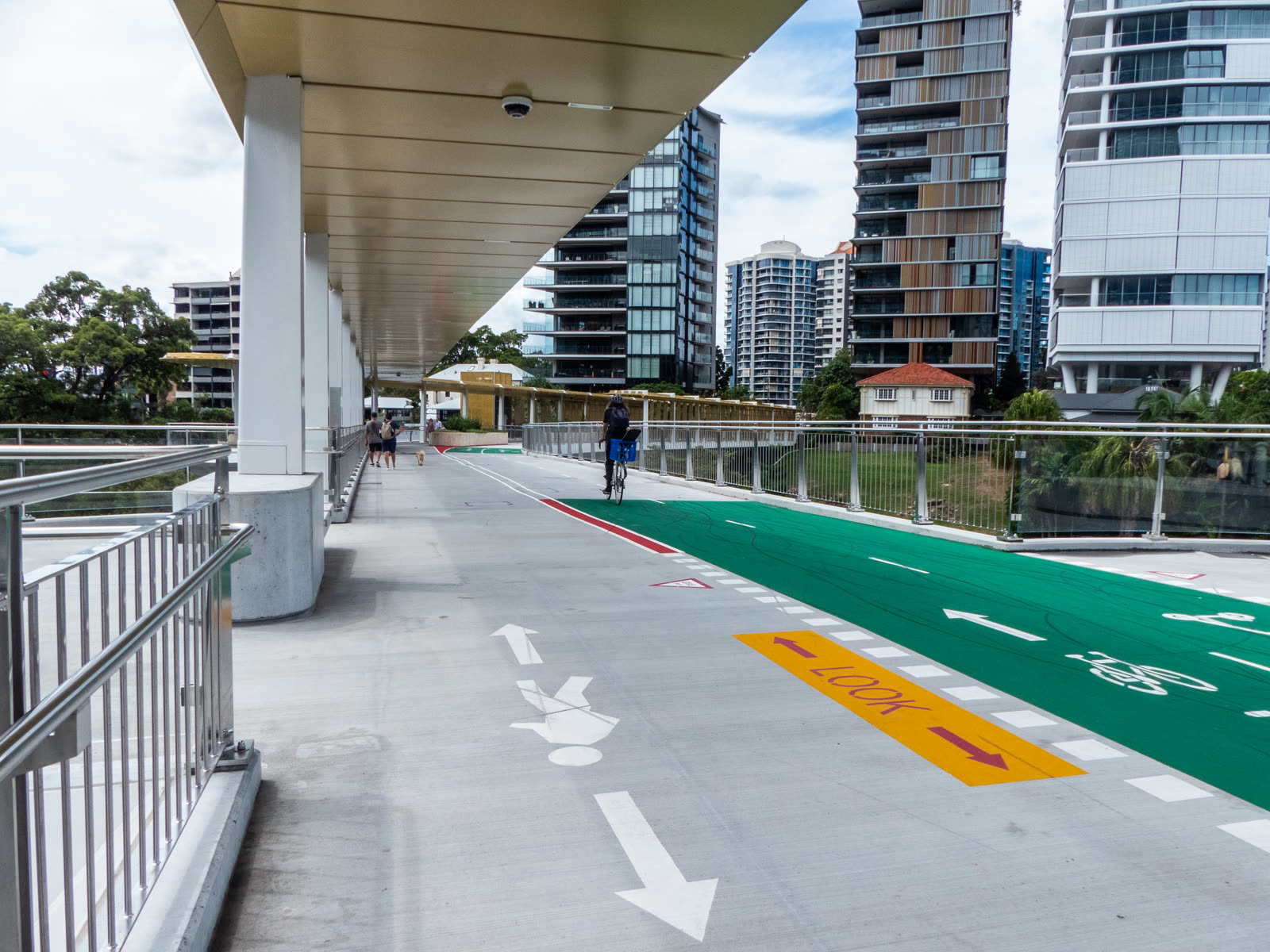
The bridge is best understood as a release. Brisbane City Council describes it as a new walking-and-riding connection with separated lanes, an underpass beneath the Story Bridge, and access to surrounding riverwalk sections via lift and stairs.[2] Must Do Brisbane makes the user experience plain: the bridge is Brisbane's newest cross-river pedestrian link, it spans 460 metres, and its public viewing platforms give broad views back to the CBD, the river, Story Bridge, and the Kangaroo Point cliffs.[5]
That is why you should cross it after the cliff sequence, not before. If the bridge comes first, Kangaroo Point risks feeling like an appendage to the city side. If the cliffs come first, the crossing becomes a rereading tool. You have already seen the stone from above and below. The bridge then turns the same scene into a wider civic picture.
The bridge also introduces one local discipline visitors often miss. It is not a scenic balcony that happens to permit bicycles. It is a real transport link. The council page is explicit about separated pedestrian and bike paths.[2] If you drift across the wrong lane for skyline photos at peak commuting hour, you are no longer using the place well. You are just making it worse for the people who actually move through it every day.
8 local moves that materially improve this Brisbane stop
- Start on the upper cliffs at River Terrace, not on the lower path. The quarry edge is the right first read; the riverwalk is the second.[1][3]
- Enter about 60 to 90 minutes before sunset. That gives you one usable daylight phase on the cliffs and one early-light phase on the bridge.[4][5][6]
- Treat the 107-step staircase as a one-time change of level, not a fitness challenge. One descent is enough to make the route click.[1][6]
- Keep the core budget at AUD 0. The parks and bridge are the point; paid food or drinks are optional, not structural.[1][2][5]
- After the stairs, stay on the lower boardwalk long enough to feel the quarry wall overhead. This is where Kangaroo Point stops being generic riverfront and becomes specifically Brisbane.[3][4]
- Use the bridge as your exit or reset, not as your arrival gimmick. The 460-metre crossing works best once the cliffs are already in your eye.[2][5]
- Hold your photos from the pedestrian side only. The bridge is a live commuter corridor with separated lanes for a reason.[2]
- If you still have energy, stop briefly at the landing above C.T. White Park, then move on. Do not invent a third major anchor and dilute the close-up.[1][2]
Non-local trapline: 4 common mistakes and the cleaner alternative
Mistake 1: treating Kangaroo Point as one static lookout on River Terrace
Better move: read both levels. The cliffs only make sense when the upper skyline view hands off to the lower quarry-and-river edge.[1][3][4]
Mistake 2: doing the stairs repeatedly for exercise or photos and calling that the whole visit
Better move: use the 107 steps once as a structural hinge, then keep the rest of the route horizontal.[1][6]
Mistake 3: crossing the bridge first and leaving the cliffs for "if there's time"
Better move: let the bridge close the route. The crossing becomes more meaningful after the stone face and boardwalk have already set the scene.[2][5]
Mistake 4: forgetting that the bridge is still a working transport link
Better move: stay in the pedestrian lane, keep your pauses short at busier moments, and treat the viewing platforms as pauses inside movement, not as private terrace space.[2][5]
Concrete go details
- Best window: 60-90 minutes before sunset into first light-on across the CBD.[4][5][6]
- Expected spend: AUD 0 for the core route.[1][2]
- Queue and reservation reality: none for the park and bridge themselves; only bridge dining venues add booking logic.[1][2][5]
- Where to stand or sit: brief stop on the upper cliffs, longer pause on the lower boardwalk, final look from the bridge viewing edge.[1][4][5]
- Navigation cue:
River Terrace upper cliffs -> 107-step staircase -> lower boardwalk -> Scott Street landing -> Kangaroo Point Bridge.[1][2] - Numeric anchors worth keeping: 8 parks, 24 hours, 20 metres, 107 steps, 460 metres, 1826, 1886-1888, 1976, 5 kilometres, 15 December 2024.[1][2][3][4][5]
Brisbane often gets sold through broad river panoramas and rooftop shorthand. Kangaroo Point offers a better lesson. Start with stone, drop to the water, and only then take the bridge. The city becomes legible because the sequence is right.
Sources
- Brisbane City Council, "Kangaroo Point parks" (official page on the eight parks, 24-hour access, 20-metre cliffs, 107-step staircase, facilities, and the 460-metre bridge FAQ).
- Brisbane City Council, "Kangaroo Point Bridge" (official page on the bridge connections, separated pedestrian and bike paths, lift and stair access, and panoramic outlook).
- Brisbane City Council, "Brisbane River Heritage Trail" (official heritage account of the Kangaroo Point quarry from 1826 to closure in 1976, plus the naval depot context).
- Must Do Brisbane, "Kangaroo Point City" (updated 2025-12-11; local walk guide describing the 5-kilometre circuit, lower boardwalk, pocket parks, and quarry-edge texture).
- Must Do Brisbane, "Kangaroo Point Bridge" (updated 2026-01-20; local guide on the 460-metre pedestrian link, viewing platforms, and how locals now use the crossing).
- Urban List Brisbane, "8 Of Brisbane's Best Running Tracks To Get Your Heart Pumping" (published 2024-06-20; local lifestyle guide on starting or ending the day at the cliffs and using the stairs and bridge as a real movement corridor).
- Google Maps search, "Kangaroo Point Cliffs Park" (current community-review and place-status surface; accessed 2026-04-16).
- Google Maps search, "Kangaroo Point Bridge" (current community-review and place-status surface; accessed 2026-04-16).
- Wikimedia Commons, "File:Kangaroo Point Bridge, Brisbane CBD to Kangaroo Point, Town Reach of Brisbane River P1120825.jpg" (documentary photograph used for the cover image).