A forest camera can be wrong in two dangerous directions. Set it too cautiously and a pale thread of early smoke disappears into the sky. Set it too eagerly and fog, cloud, reflected water, dust, a bright wall, or steam becomes a fire. The second error looks safer until every false alert asks a person to inspect kilometres of terrain. Then attention becomes the scarce resource, and the system built to notice everything teaches its operators to trust nothing.
As of August 29, 2026, the most interesting signal in China's forest-fire AI is therefore not a larger vision model or one more claimed accuracy record. It is the construction of a hard-negative data loop: detectors surface confusing scenes; people decide what was actually present; those mistakes return as training and test material; time, weather, geography, and a second look filter the next alarm; a human still confirms the event before crews move.
That pattern is visible at three scales. A University of Science and Technology of China team has described a camera system built around false detections gathered from real deployments. Zhejiang has turned a province-wide alarm queue into a locally labelled dataset. National policy and a new monitoring standard are pushing cameras, satellites, weather, communications, and response organizations into one system rather than treating a bounding box as a verdict.[1][2][3][4]
The shift is real. The public evidence is not yet a complete safety case.
A fire detector mostly looks at no fire
The imbalance is easy to miss in a model demo. A dramatic clip contains smoke; the detector finds it; a box appears. An operating camera spends almost all of its life looking at ordinary forest, changing light, and weather. Reliability depends on what happens during those long negative hours.
The 2025 SKLFS-WildFire test set makes that asymmetry unusually visible. Its creators assembled 3,309 short video clips, but only 340 contain real wildfire smoke. Of 50,735 sampled frames, 3,588 contain smoke—about 7 percent. The negative scenes were not chosen at random. Many came from the false detections of earlier Faster R-CNN and YOLO models, while the test locations were separated geographically from the training locations.[3]
That is a more useful design than filling a folder with obvious flames and clean blue skies. It asks whether a detector can distinguish an incipient plume from the exact things that have already fooled detectors in practice. The authors say their model was evaluated across 1,200 ground-mounted cameras, but they do not publish a site-by-site operating ledger, and the training split remains private for user-privacy reasons. The dataset is valuable evidence inside a named setup; it is not a national reliability score.[3]
The deeper lesson is that “negative” does not mean empty. A useful negative frame may contain the hardest object in the system: something that looks enough like smoke to deserve a second look. Yesterday's embarrassment becomes tomorrow's test case.
Fog is a systems problem, not a corner case
Fog is especially revealing because more examples cannot fully erase the visual ambiguity. The USTC paper identifies fog as its most critical false-alarm source and also records trouble from water reflections, plants, small distant objects, divergent viewpoints, and fully diffused smoke. The authors propose adding humidity and precipitation data and using motion across time because smoke and fog may resemble each other in one frame while behaving differently over several.[3]
Scale amplifies the problem. The paper says a pan-tilt-zoom forest camera commonly watches to about 5 kilometres, implying roughly 80 square kilometres of coverage. Raw detections over that area could produce hundreds or thousands of alerts a day. Even a true fire can generate repeated boxes several times per second—far more notifications than an operator can use.[3]
So the deployed system does not pass every model output downstream. A six-second sliding window requires smoke detections in more than 60 percent of frames. When a patrol drone sees something suspicious, it pauses and “gazes” at the area for another six seconds. A geographic cooling rule can suppress repeat alerts within about 500 metres for 30 minutes. Known regions such as water, sky, buildings, factories, walls, and roads can be masked or ignored. Only then does a candidate clip reach a person for confirmation; a confirmed alarm moves to wildfire personnel.[3]
None of those controls is a glamorous foundation-model breakthrough. Together they may matter more than one extra point on an image benchmark. They convert a detector that reacts to pixels into an alarm system that reasons, in a limited engineering sense, over persistence, place, context, and operator capacity.
There is a tradeoff. Smoothing can suppress a brief real signal. An ignore zone can hide a fire beside a familiar reflective surface. A 30-minute cooling window can merge separate events. The right question is not whether post-processing removes false alerts. It is whether the whole configuration lowers false alerts without quietly lowering recall where early smoke is faintest.
Zhejiang turned the alarm queue into regional data
Zhejiang's deployment shows the same logic at administrative scale. The province began building its “AI + forest-fire warning system” in the fourth quarter of 2025 and put it into trial operation in early 2026. The system combines satellite remote sensing, weather radar, and high-mounted video rather than relying on a single sensor type.[4]
The official account is frank about the initial problem: front-end monitoring produced too many false alarms. In response, Zhejiang collected more than 230,000 visible-light fire-warning images, over 20,000 satellite records, and more than 5,000 synthetic-aperture-radar records. It says the resulting dataset contains over 250,000 structured annotations spanning different times, weather, terrain, vegetation, smoke, hotspots, and interference scenes, and that model-recognition accuracy rose above 90 percent.[4]
That percentage should remain inside the source's boundary. The report does not publish a confusion matrix, a denominator, the proportion of actual fires, a held-out regional split, or performance by fog, season, and sensor. It cannot be compared directly with the USTC paper's image-, video-, and box-level measures. “Accuracy” across a provincial multimodal system may describe a different task altogether.
The workflow is more informative than the headline score. Zhejiang says candidate warnings can reach command centres within 30 seconds through government messaging and SMS. A warning is reviewed; only a confirmed fire triggers the province's “1618” response system, local crews, aerial reconnaissance, and a temporary four-level coordination group. The source also says incident data feed later model improvement.[4]
That sequence turns local weather and terrain into a durable asset. Coastal haze, a reservoir reflection, mountain fog, and smoke against a particular forest type are not generic edge cases. They are regional operating conditions. A national model may start the system, but the local false-alarm archive is what teaches it where it lives.
The national design is becoming multi-source by default
China's policy architecture increasingly assumes that no single view is sufficient. A September 2024 implementation opinion called for a national warning-and-monitoring system joining emergency-management, forestry, meteorological, satellite, aerial, video, lookout, and ground-patrol data. It set staged work through 2029: shared data and multi-scale monitoring in 2025, further lightning-fire and post-fire assessment work in 2026, and a more complete national warning network by 2029.[1]
On May 1, 2026, a new recommended national standard, GB/T 47058-2026, took effect for forest and grassland fire-prevention video-monitoring systems. Its drafting roster spans the National Forestry and Grassland Administration, research institutes, universities, camera and telecom companies, China Tower units, and a local prevention centre.[2] A standard does not prove that every installed system works. It does show the problem crossing from isolated projects into shared requirements for equipment and operations.
The practical architecture is a ladder of imperfect witnesses. A satellite hotspot may be broad or delayed. A tower camera may confuse fog with smoke. A drone can move closer but has limited flight time and weather tolerance. Meteorological data can explain likely fog but not rule out fire. A ranger sees context but cannot watch every slope. The system becomes credible when these sources can challenge and confirm one another—and when their disagreement is preserved rather than flattened into a confident score.
The feedback loop still needs roads made of fibre
Model quality is useless if a mountaintop camera cannot return video. A 2026 account from Inner Mongolia's Greater Khingan forest region makes the infrastructure dependency concrete. It reports 409 communications base stations and 5,261 kilometres of fibre across the forest network after several rounds of universal-service construction. A newer smart-forestry project was still only 72.32 percent complete at publication, with 50 drone docks installed across 14 priority areas and upgrades under way at 199 high-elevation video sites.[5]
The operator says video return at those sites rose above 80 percent, false alarms fell by 80 percent, and response time dropped below 15 minutes.[5] Those are operator-reported outcomes, not independently audited comparisons, and the account does not say whether fewer false alarms came from better classification, different thresholds, more human filtering, or changed weather. Still, it exposes the right dependency chain: power, backhaul, camera uptime, model inference, secondary review, and dispatch all have to work before a labelled mistake can return to the dataset.
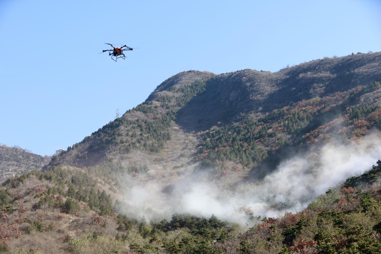
The cover photograph shows the downstream texture of that chain. At Beijing's Ming Tombs Forest Farm in November 2025, a drone flew during an exercise supported by 1,040 forest video feeds, 31 fire-risk stations, round-the-clock duty, and 159 local firefighting teams. The aircraft is visually compelling; the staffed network around it is the actual operating system.[6]
One accuracy figure is not the safety case
The next useful disclosures from China's forest-fire AI projects would make the alarm ledger inspectable. At minimum, that means recall on independently verified fires; false alerts per camera-day; operator minutes spent per false alert; time from first candidate to confirmation and dispatch; results separated by fog, rain, snow, terrain, season, distance, and sensor; and performance before and after each model or threshold change.
Suppression needs its own audit. How many candidate alarms were removed by temporal smoothing, geographic cooling, weather filters, and ignore zones? How many of those were later found to be real? When a human rejects an alert, does the system keep the clip, the reason, the weather state, and the model version? Can a test set from Zhejiang transfer to Inner Mongolia without confusing a new landscape in a new way?
Those questions separate a data flywheel from a slogan. If false alerts fall only because the system becomes reluctant to report faint smoke, the hard-negative loop has optimized the queue at the expense of the mission. If false alerts fall while independently verified early-fire recall and time-to-dispatch hold or improve across seasons, then the feedback architecture is doing something much more valuable than polishing a demo.
Forest-fire AI will never learn a final, universal shape for “not smoke.” Weather changes; cameras age; vegetation grows; new construction enters the frame; operators change thresholds; a fire begins where yesterday there was only glare. The durable advantage is not a detector that stops being wrong. It is a system organized to notice how it was wrong, keep the evidence, and make the next alarm earn attention.
Sources
- National Forest and Grassland Fire Prevention and Extinguishing Command, “Implementation Opinion on Strengthening Forest and Grassland Fire Early-Warning and Monitoring Systems” (September 30, 2024; national multi-source architecture and staged timetable).
- National Public Service Platform for Standards Information, “GB/T 47058-2026: Technical specification for forest and grassland fire prevention video monitoring system” (published January 28 and effective May 1, 2026).
- Chong Wang et al., “Wildfire Smoke Detection System: Model Architecture, Training Mechanism, and Dataset,” International Journal of Intelligent Systems (July 5, 2025; dataset boundary, deployment pipeline, hard negatives, post-processing, and limitations).
- Zhejiang Provincial Department of Emergency Management, “Zhejiang uses AI technology to assist forest-fire prevention and control” (March 30, 2026; multimodal dataset, false-alarm response, review, dispatch, and feedback claims).
- National Forestry and Grassland Administration / Inner Mongolia Daily, “Smart forestry and ecotourism: practices of Inner Mongolia Forest Industry Group” (January 2026; communications build-out, monitoring deployment, and operator-reported outcomes).
- Beijing Daily, “With more combustible material under Beijing's forests this winter, an integrated warning system stands ready” (November 11, 2025; Ming Tombs exercise, monitoring network, response staffing, and source photograph by He Jianyong).