When two OpenStreetMap contributors disagree about a road, the project's first governance body is not the Foundation board. It is the record wrapped around the edit: a changeset with an author, a place, a timestamp, a human explanation, and a public thread where another mapper can ask what happened. That small design choice makes the argument inspectable before it makes the argument official.
This is OpenStreetMap's strongest governance signal in 2026. Authority is available, but it arrives in layers. A local mapper questions an edit. The editor can explain or repair it. A careful revert can restore data without erasing the history. The volunteer Data Working Group steps in when ordinary community methods fail, and a serious complaint about that group's decision can reach the OpenStreetMap Foundation board.[1][2][3] The system is neither leaderless nor centrally edited. It is an escalation path designed to keep local knowledge and procedural evidence attached to the same evolving database.
That distinction matters to anyone planning organized, automated, or corporate mapping. Open access to the editing API is not permission to impose a globally tidy schema. The operational contract is stricter: make a bounded change, disclose how it was made, leave an intelligible trail, listen to the people who know the place, and be prepared to reverse it safely.
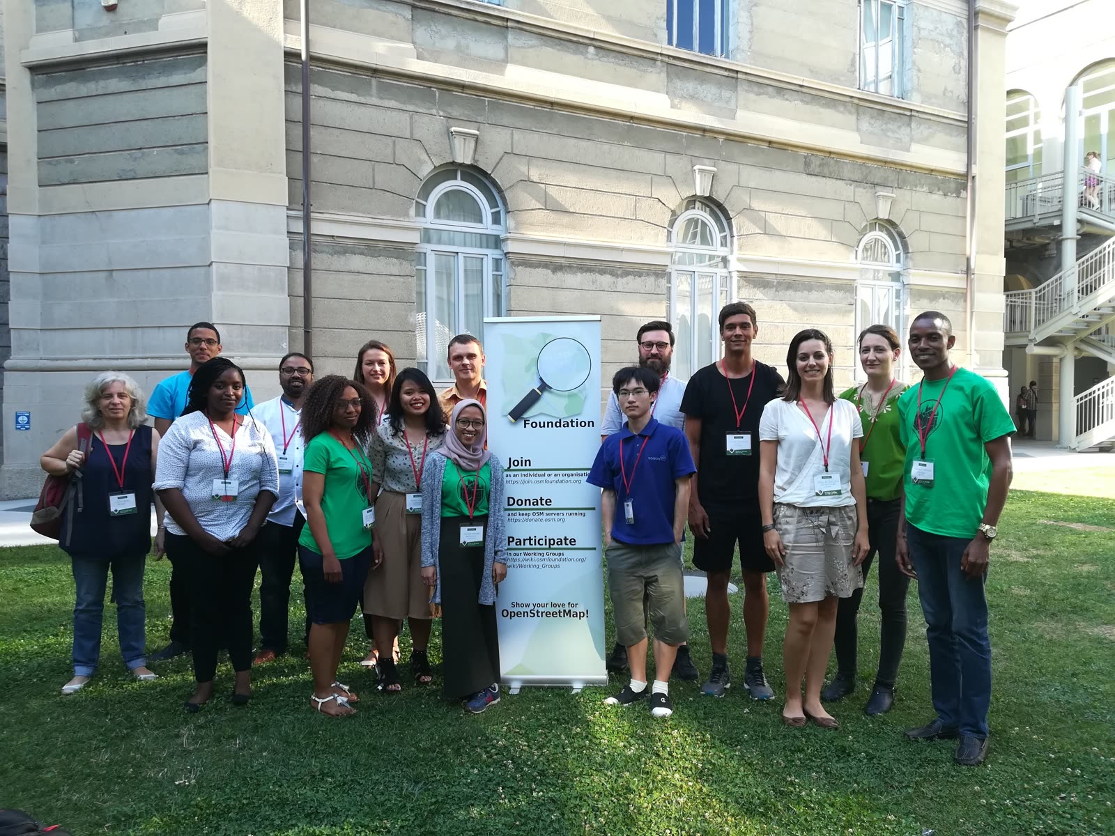
Image context: the cover shows State of the Map scholarship recipients beside an OpenStreetMap Foundation banner in Milan in 2018. It is a useful governance image because it shows a plural community gathered around the institution. OSMF supplies infrastructure and specialist working groups; it does not replace the contributors whose situated knowledge makes the map credible.[4][7]
The edit carries its own review surface
A changeset groups database edits made by one user over a short period. Its metadata can include comment=* for the human explanation, created_by=* for the editor or script, source=* for the evidence used, bot=yes for automation, and review_requested=yes when the mapper actively wants another set of eyes. Every changeset is addressable at a stable path such as /changeset/123, and its discussion is public.[1]
Those fields do more than improve etiquette. They bind four questions to the same object: what changed, where, by whom, and why. A reviewer does not need a private project dashboard to reconstruct the mapper's intent. Other local contributors can join the thread, sources can be challenged, and the eventual correction can point back to the original edit.
Geographic size is therefore a governance property, not merely an upload preference. The community documentation recommends keeping changesets local—often within a city, district, province, or country—because a planet-spanning batch floods regional review filters and is harder to understand or reverse.[1] The technically efficient unit is not always the socially reviewable unit. One script may be able to rename a tag everywhere in minutes; the map still crosses languages, conventions, legal categories, and physical realities that the script's author may never have encountered.
This is why a descriptive changeset comment beats a vague claim that an edit is “correct.” It does not settle the dispute. It gives the dispute an address.
Reverting restores state; it does not erase the case
OpenStreetMap's rollback model preserves an important difference between correction and deletion. A normal revert changes affected objects back toward their earlier state, as if a mapper had manually restored them. The intervening versions remain in history. If nobody has touched those objects since the problematic changeset, the revert can be clean. If later contributors have built on them, it becomes a dirty revert with conflicts and a real risk of overwriting good work.[2]
The community guidance reflects that technical cost. Except for plainly malicious or urgent damage, it asks a reverter to contact the contributor politely and allow at least one week for a response. It warns against using rollback as a weapon in an edit war and recommends seeking experienced help when the operation is uncertain.[2] “Undo” is not a magic transaction over an isolated document; it is another edit against shared, moving state.
There is one revealing exception. When material copied from an incompatible source enters OSM, an ordinary revert is insufficient because the prohibited version would remain in object history. The Data Working Group has a special redaction power that can hide that version entirely.[3] The separation is healthy: community members can correct map state, while destructive removal from the historical record is reserved for a narrower license and privacy boundary.
For an engineering team, the practical lesson is precise. Store the changeset IDs created by a job. Keep the source snapshot and transformation version that produced them. Split work into regions that humans can review. Test the reverse operation before the full run. If the rollback plan is “ask the database to forget this happened,” it is not an OpenStreetMap rollback plan.
Automation has to ask before it scales
The automated-edits code of conduct turns those mechanics into a contribution contract. A proposed systematic edit should be documented in advance with its operator, motivation, algorithm, consultation record, schedule, and opt-out method. Discussion may happen in a local Telegram, Slack, Facebook, or Signal group, but the policy also calls for a durable record on the community forum or wiki. A new bot should begin with a small number of edits, mark its changesets, group them into human-scale regions, and retain what is needed for a revert.[5]
The policy's most consequential sentence is procedural: OpenStreetMap works through consensus rather than a simple majority vote, and the wiki is not the final arbiter of correct tagging.[5] That blocks a familiar failure mode in open data. A team writes a neat schema rule, finds that most people in one discussion support it, and then runs code across places where the rule has a different meaning. Documentation can record practice; it cannot manufacture local agreement everywhere.
The boundary is demanding but workable. A two-person civic project correcting a documented local import can consult the relevant community, publish its logic, run a small sample, and expand after review. A platform company changing millions of objects has a larger obligation because its throughput magnifies a mistaken assumption. More compute should produce more evidence and smaller failure domains, not a larger presumption of authority.
Specialist authority begins after ordinary communication
The Data Working Group handles copyright violations, disputed mapping, vandalism, bots, problematic imports, and cases beyond normal community resolution. Its own page says its most common action is helping mappers communicate. It normally asks people to begin with a changeset discussion; when that fails, a report should include concrete objects or changesets, an explanation of what is wrong, and links to relevant local-language discussion.[3]
The group can do things an ordinary mapper cannot. It can redact incompatible historical versions, hide offensive or accidentally exposed text, and issue user blocks lasting from an hour to ten years. Yet most blocks are effectively zero-hour read receipts: the user must see a message before editing again, without serving a period of exclusion. The page says contact is usually attempted first.[3] That is a revealing use of privileged access. The first objective is to reopen a broken communication channel, not to maximize punishment.
Review is imperfect and recognizably human. A single DWG member often handles a related set of complaints; colleagues may discuss it informally, while formal votes are rare. A person who believes the treatment was unfair can request another member's review. After that, a matter of real importance can be taken to the OSMF board, which may mediate or overrule the group.[3] There is an appeal path, but no fiction that every case is a miniature court proceeding.
The Foundation's other working groups clarify what this authority does not include. Licensing handles license questions. Operations plans and maintains the API and servers. Engineering coordinates Foundation-funded software work. The Data Working Group protects and arbitrates the shared data.[4] A tile-rendering complaint, server incident, copyright question, and mapper dispute may touch the same map while belonging to different decision systems.
Public process does not dissolve power
The limits deserve equal weight. An independent 2024 study by Aarjav Chauhan, Dipto Sarkar, Taneea S. Agrawaal, and Robert Soden examined OSM's talk and osmf-talk archives from November 2013 through July 2021. The researchers found 907 messages across 57 threads, then narrowed the corpus to 139 messages directly relevant to corporate influence, organized editing, and remote mapping. Their analysis describes recurring tensions among local knowledge, data quality, transparency, contributor autonomy, and inclusion—and shows how debate over corporate editing helped produce policies that require visible communication and contact with affected local communities.[6]
That study is an analysis of primarily English-language mailing lists, not a census of every mapper or local channel. Its boundary reinforces the larger point: a visible thread improves accountability without making participants equal. A paid editing team may have more time, tooling, and institutional backing than a local volunteer. English-language documentation may be easier for one side to navigate. A correct appeal route may still consume scarce volunteer attention. The DWG's informal case handling provides flexibility, but it also means adopters should not treat the group as a guaranteed support desk with a contractual response time.
Good governance here is not the absence of disagreement. It is the ability to keep disagreement from becoming invisible data churn. The changeset preserves intent. The discussion invites local evidence. The revert preserves history. Redaction is narrow. Specialist intervention is reviewable. The board remains an appeal layer rather than the editor of first resort.
For organizations contributing at scale, that yields a practical adoption boundary. OpenStreetMap is a strong fit when the team can expose its methods, assign humans to answer comments, respect local variation, keep batches reviewable, and stop when objections reveal a faulty assumption. It is a weak fit when the operating model requires silent mass correction, proprietary evidence that cannot be examined, or an external volunteer body to absorb the team's quality-control burden.
The falsifier is simple: if contributors can no longer connect a disputed feature to a bounded edit, a reason, a responsible operator, and a reachable escalation path, the governance signal has failed—even if the map still renders. OpenStreetMap's resilience comes from keeping those links intact. The committee matters at the hard edge; the comment is where governability begins.
Sources
- OpenStreetMap community, “Changeset” — changeset scope, locality guidance, metadata tags, public discussions, review requests, and escalation when comments go unanswered.
- OpenStreetMap community, “Change rollback” — responsible contact, one-week response guidance, clean and dirty reverts, retained history, and operational hazards.
- OpenStreetMap Foundation, “Data Working Group” — remit, communication-first workflow, special privileges, block range, second-review request, and board appeal path.
- OpenStreetMap Foundation, “Working Groups” — separation of data, licensing, operations, engineering, communications, membership, and local-community responsibilities.
- OpenStreetMap community, “Automated Edits code of conduct” — proposal documentation, durable consultation record, consensus boundary, trial batches, changeset labeling, regional grouping, and opt-outs.
- Aarjav Chauhan, Dipto Sarkar, Taneea S. Agrawaal, and Robert Soden, “Value Tensions in OpenStreetMap: Openness, Membership, and Policy in Online Communities,” Proceedings of the ACM on Human-Computer Interaction, 2024 — independent qualitative analysis of corporate-editing debates, policy formation, and tensions among local mapping, transparency, autonomy, quality, and inclusion.
- Kateregga1, “State of the Map 2018 Scholars,” Wikimedia Commons — provenance page for the documentary photograph of scholarship recipients in Milan used as the article image.