The hardest problem in a humanitarian mapathon is not drawing one building. It is letting hundreds or thousands of people draw different buildings at once without duplicating work, losing context, or mistaking a colored progress grid for a trustworthy map. HOT Tasking Manager addresses that coordination problem. It takes an area of interest, divides it into bounded tasks, gives each task a temporary owner, and sends completed work toward a second mapper for review.[1][3]
That makes the software easy to describe and easy to misunderstand. Tasking Manager is not the OpenStreetMap database, and it is not primarily the editor that creates roads or building outlines. It is a coordination plane above both. Its durable idea is a human-work state machine: available, locked, mapped, validated, or returned for more work. The map can outlive any one Tasking Manager instance; the state machine makes a burst of parallel editing governable.
The architecture also has an honest weakness. A lock can keep two volunteers from deliberately claiming the same square, but a road does not stop at the square's edge. A validation status can record that one bounded area received a second look, but it cannot prove that neighboring areas join cleanly. Tasking Manager scales attention by partitioning space. The partition is also where quality can fracture.
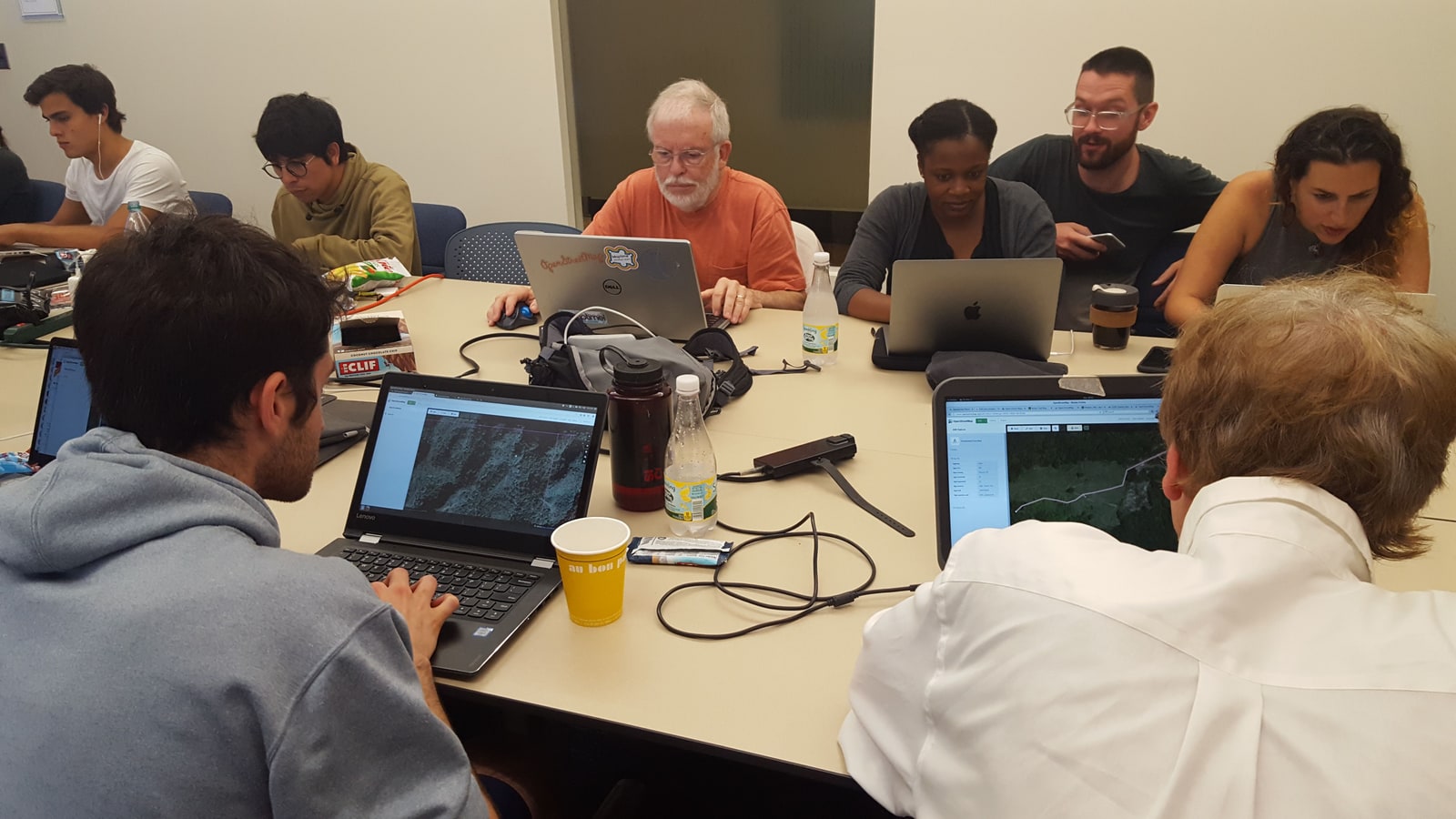
Image context: the cover photograph records a 2017 mapathon in MIT's Dewey Library, where 45 volunteers used a HOT Tasking Manager project to trace pre-disaster structures in Puerto Rico after Hurricane Maria. The laptops and shared table are not generic “people using technology” scenery. They show the concurrency problem the software was built to organize.[8]
Three systems make one contribution
The official learning guide names the separation plainly. OpenStreetMap is the geographic database. Tasking Manager coordinates collaborative work on a chosen area. An editor such as iD or JOSM reads and writes the actual map data.[3] A contributor may experience the three as one flow, but they have different authorities.
Tasking Manager owns project intent: the area, instructions, allowed imagery, task boundaries, difficulty, priority, permissions, comments, and workflow status. The editor owns the geometry-editing session. OpenStreetMap accepts the resulting changeset and remains the source of truth for the map. Marking a task complete therefore records a claim about work; it does not copy a private Tasking Manager map into production. The edits have already been saved to OpenStreetMap through the editor, and the mapper returns to Tasking Manager to report the task's state.[3]
The source tree reflects this role as a web coordination service rather than a GIS desktop application. The current repository separates frontend, backend, database migrations, and tests. It identifies a React/JavaScript front end, a Python/FastAPI back end, and PostgreSQL/PostGIS in the stack; its 2025 roadmap records the FastAPI migration, while the project can be deployed as independent community instances under a BSD-2-Clause license.[2] Those implementation choices can change. The important boundary is steadier: Tasking Manager stores who should work where and what the workflow believes happened; OpenStreetMap stores the shared geographic edits.
That split is operationally useful. A project manager can change instructions, restrict validation to a team, or archive a finished campaign without creating a fork of OpenStreetMap. A mapper can use a browser editor or JOSM without teaching Tasking Manager every geometry operation. Multiple Tasking Manager installations can coordinate different communities against the same larger mapping commons.[2][4]
The grid is a work queue
A project begins with geography, but its first important output is a queue. An administrator can draw an area of interest or upload GeoJSON, KML, or a zipped shapefile. Tasking Manager can divide that shape into grid cells, or accept imported polygons as the tasks themselves. The administrator then sets the instructions, imagery, permissions, mapper level, validation policy, and editor choices that travel with the work.[4]
Task size is not cosmetic. A square that is too large may contain more dense tracing than one person can finish before a lock expires. A square that is too small strips away the context needed to classify a road or follow a waterway. The administrator guide exposes technical ceilings of 5,000 square kilometers and 5,000 tasks for a project, while recommending much smaller projects—under 1,000 square kilometers and under 1,000 tasks—so completion remains manageable.[4] These numbers constrain the database and interface, but the human constraint arrives sooner: can one mapper understand the instructions, inspect the imagery, and finish a coherent unit of work?
Once published, the grid behaves like a spatial job queue. Uncolored tasks are available; a mapper claims one; pale blue indicates work ready for validation; yellow means more mapping is needed; green means validated. Priority and permissions decide which jobs are visible or selectable. Comments preserve local handoff notes such as cloud cover, ambiguous features, or an unfinished corner.[3]
This is a good abstraction because it makes progress inspectable without requiring a central dispatcher to assign every building. It is a dangerous abstraction if the dashboard becomes the goal. “One hundred percent mapped” means every task has been marked mapped. “One hundred percent validated” means the validation workflow has closed every task. Neither percentage independently measures positional accuracy, tagging consistency, freshness, or usefulness to the organization that requested the data.[5]
The two-hour lock is a lease, not a transaction
When a mapper starts a task, Tasking Manager locks it and begins a two-hour countdown. The guide warns that the task is automatically released after 120 minutes; if a second mapper claims it while the first is still editing, both may touch the same OpenStreetMap objects and create conflicts.[3] The timer is best read as a lease on attention. It reduces duplicate effort while ensuring an abandoned browser tab cannot reserve part of a project forever.
It is not a database transaction around the map. OpenStreetMap contributors outside the project can still edit the area. A mapper can cross a task boundary, and some features must cross it: roads, waterways, and buildings do not respect the work grid. The editor ultimately negotiates object versions with OpenStreetMap, not with Tasking Manager. The lock coordinates cooperative participants; it does not impose exclusive geographic ownership.
That is why the handoff carries more than a status color. The project supplies a changeset comment and source context for the editor, and the task history can retain mapper comments and state transitions.[3] Together, the task number, user, timestamps, instructions, comments, and OpenStreetMap changeset provide an evidence trail. They are related records, however, not one atomic commit. An operator investigating a bad edit may need to reconcile Tasking Manager history with OpenStreetMap history rather than expecting one log to contain the whole event.
This distinction matters most under pressure. A lock protects throughput. A changeset protects map history. A comment protects handoff context. None substitutes for the others, and none by itself certifies the geometry.
Validation is a second queue
After a mapper submits a task as complete, a more experienced contributor reviews the relevant OpenStreetMap data, fixes small issues, and either validates the task or returns it with guidance. Tasking Manager blocks a contributor from validating the same task they marked as mapped; project managers can also restrict validation by experience or team.[5] This is not merely approval. Good validation closes errors and teaches the mapper who created them.
The state transition creates a second queue with a scarcer worker pool. A 2024 process study examined 746 completed, fully validated, archived HOT Tasking Manager projects. The common path through mapping and validation was clear, but the researchers identified the wait from mapping to validation as a major bottleneck and interpreted it as evidence that validation capacity can be scarce.[6] Parallel tracing can expand faster than expert review.
That finding changes how a project should be staffed. Recruiting 500 beginners without recruiting validators may make the blue portion of the grid grow quickly while the trusted green portion stalls. Making tasks smaller may increase apparent throughput while multiplying handoffs. Lowering validation permissions may empty the queue but weaken the independence and experience that give the review stage value. The architecture exposes these tradeoffs; it does not resolve them automatically.
The failure mode is familiar to software teams. Mapping is feature production; validation is review. A system that measures opened and completed work but ignores review latency will optimize the wrong queue.
Every tile has an edge
Microtasks make a large area cognitively and socially manageable. They also encourage each mapper to treat a local crop as the whole problem. The official guidance tells contributors to avoid ranging far outside their square, yet to extend roads, streams, and other crossing features slightly beyond the boundary so the next mapper can continue them.[3] That small exception reveals the core tension: isolation prevents collisions, while continuity requires looking across the isolation boundary.
Recent research makes the seam risk concrete. A 2026 study analyzed 4,619 Tasking Manager projects and more than 1.4 million microtasks. It reported both edge-based distortions and task-wide inconsistencies associated with microtask aggregation, and proposed measures such as overlapping boundaries and better implicit coordination.[7] The result does not mean partitioning is a mistake. It means task completion is a local signal, while map coherence is a neighborhood property.
The validation guide therefore recommends a wider final pass after ordinary mapping and task validation, specifically checking continuity of highways and waterways across the project before the data is treated as ready for use.[5] This third view changes scale. The mapper asks whether one square is complete. The validator asks whether that square is correct. The project-level reviewer asks whether the squares make one map.
No task-state enum can answer the last question alone. A disconnected road may sit in two individually green tasks. Two neighboring mappers may interpret imagery or tagging instructions differently. A building on a border may be missed by both or drawn twice. These are not exceptions around an otherwise perfect grid; they are consequences of turning continuous geography into discrete work units.
What a sound deployment watches
For a community running Tasking Manager, the most consequential settings are social architecture expressed as configuration. Keep the area small enough to finish. Choose task sizes that fit the imagery density and mapper skill. Write instructions that identify the requested features, tags, imagery, and known ambiguities. Restrict difficult projects appropriately. Recruit validators before the mapped queue spikes. Sample across task boundaries, and reserve a project-wide continuity pass before downstream use.[4][5][6]
Operational ownership matters too. A self-hosted instance needs people who can maintain the FastAPI/PostGIS service, upgrades, authentication integration, backups, and project records.[2] A mapping campaign also needs people who can answer questions, correct poor instructions, handle problematic imagery, and pause or archive a project whose output is deteriorating. Keeping the web service healthy is necessary; keeping the work definition healthy is the larger reliability job.
Tasking Manager fits when many contributors need to produce bounded OpenStreetMap edits against a common brief and when a real validation path exists. It fits less well when work cannot be partitioned without losing essential context, when source material is too ambiguous for remote tracing, or when the requesting organization cannot explain how the finished map will be checked and used. In those cases, a bright progress grid can create confidence faster than evidence.
The architectural lesson reaches beyond mapping. HOT Tasking Manager does not scale by making each volunteer omniscient. It scales by making ownership temporary, state visible, and review explicit. Its best design choice is also its permanent warning: dividing the world makes the work possible, but someone must still look across the lines.
Sources
- Humanitarian OpenStreetMap Team, “Tasking Manager” — official product overview of project subdivision, task assignment, parallel mapping, validation, and data access.
- Humanitarian OpenStreetMap Team,
hotosm/tasking-manager— current source repository, component layout, technology stack, license, releases, roadmap, and community instance list. - LearnOSM, “Tasking Manager Mapper Guide” — official workflow documentation for the three-system boundary, task states, editor handoff, changeset context, two-hour locks, boundary practices, comments, and submission.
- LearnOSM, “Tasking Manager Administrator Guide” — official project-creation documentation covering areas of interest, imported polygons, grid sizing, project limits, instructions, imagery, permissions, difficulty, and lifecycle controls.
- OpenStreetMap Wiki, “Tasking Manager/Validating data” — validation roles, self-validation prohibition, invalidation and feedback, multi-task review, and project-wide third-pass guidance.
- Dagoberto José Herrera-Murillo et al., “Process Analysis in Humanitarian Voluntary Geographic Information: the case of the HOT Tasking Manager,” AGILE GIScience Series 5, 2024 — process study of 746 completed projects and the mapping-to-validation bottleneck.
- Héctor Ochoa-Ortiz et al., “Quality Issues in Crowdsourced Mapping: Microtask Aggregation in the Humanitarian OpenStreetMap Team Tasking Manager,” Transactions in GIS 30, 2026 — repository record for the 4,619-project study of edge and task-wide aggregation distortions.
- MIT News, “Mapathon seeks to direct humanitarian aid for Puerto Rico” (October 16, 2017) — report on the 45-person HOT Tasking Manager mapathon and source page for Lily Bui's documentary photograph used as the cover.