As of 2026-10-12 06:34 UTC.
The Australian Institute of Marine Science reported on October 9 that it is leading a four-year reef-monitoring collaboration involving Malaysia, Indonesia, Vietnam, Brunei Darussalam and the Philippines. Launched in Malaysia in August, the Regional Coral Reef Monitoring and Management Project aims to improve technical skills and bring monitoring datasets together, including through AIMS’s ReefCloud platform.[1]
One obstacle is already clear. In the announcement, Universiti Malaysia Terengganu’s Tan Chun Hong describes substantial existing collections that remain difficult to combine. He also calls for sharing arrangements that respect data ownership and national priorities.[1]
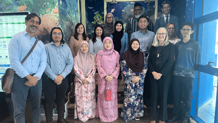
A regional project with a fieldwork history
ReefCloud’s work in the region predates the new collaboration. In June 2023, AIMS described training with Brunei’s Department of Fisheries covering collection, analysis and reporting. That phase also involved adapting the platform to users in Samoa, Vietnam and the Philippines. The emphasis was on a monitoring practice that local teams could carry forward.[2]
By May 2025, the Australian High Commission in Brunei reported that 57 local monitoring professionals had received training since 2022. It said the partnership had collected approximately 340,000 data records across 13 coastal reef sites, with continued access to software improvements and training materials.[3]
Those figures document people trained and observations assembled. They do not establish that coral condition improved. That distinction will matter when the regional project reports its own results: a larger evidence base can support a management decision, while measuring the decision’s ecological effects requires subsequent observations.
The public record separates several milestones:
| When | Documented development | What it establishes |
|---|---|---|
| June 2023 | AIMS reports Brunei field training.[2] | Earlier national capacity building |
| May 2025 | High Commission reports training and survey totals.[3] | Outputs from the Brunei partnership |
| August 2026, reported October 9 | Regional project launches in Malaysia.[1] | A collaboration entering implementation |
These are accounts from participating institutions. They provide evidence of activity and stated objectives; they are not an independent evaluation of the new project’s effectiveness.
The work after the photograph
ReefCloud accepts survey imagery and automates analysis of what covers the seabed. AIMS describes a shared workspace in which teams can process photographs, compare outputs and assemble longer records of change. The attraction is practical: reducing the queue of images awaiting analysis leaves researchers more time to interpret results and communicate them to managers.[4]
A photograph still needs a dependable interpretation. ReefCloud’s validation reports compare human and machine classifications by site and label, including differences in estimated percentage cover. Evaluation uses some human-labelled observations excluded from model training.[5]
Where a site has no human annotations, the system cannot assess agreement with an observer. Its guidance calls for annotation across the dataset and a shared labelling standard among contributors.[5]
The implication is that expertise remains part of the comparison. If two teams use a label differently, storing their photographs together leaves the disagreement unresolved. A manager needs the validation record alongside the reported change in coral cover.
What to look for next
The regional effort sits within Australia’s Southeast Asia Maritime Partnerships program.[1] DFAT describes that broader investment as A$160 million over 2024–2034, covering activities ranging from maritime enforcement to environmental monitoring and scientific cooperation. That is the umbrella program’s funding, not a stated budget for this reef project.[6]
The immediate opportunity for monitoring organisations is to connect work they already do with a common reporting process. The test is whether a manager can obtain an interpretable comparison, understand its uncertainty and use it within the permissions agreed by contributors.
For follow-up reporting, the base scenario is gradual implementation of the regional work plan. An upside trigger would be a published comparison across participating countries that includes validation results and an account of how managers used it. A downside trigger would be documented delays in sharing data or unresolved classification differences that prevent comparison. These are proposed tests of progress, not forecasts or announced deadlines.
- Next 24 hours: monitoring teams can identify their existing survey collections and the permissions attached to them.
- Next seven days: review whether dates, sites and classification labels are documented well enough for another team to interpret.
- Next 30 days: look for a public implementation timetable and reporting commitments. Revise expectations if participating institutions announce a narrower scope or delayed activities; do not count additional uploads alone as evidence of better reef condition.