As of 2026-05-10 10:02 UTC, NOAA's decision to send *NOAA Ship Thomas Jefferson back to the Great Lakes is best read as a chart-risk story, not a ship-movement anecdote.[1] The agency's May 6 update says the vessel is back in the lakes for the first time since 2022 and will spend the 2026 season mapping western and central Lake Erie and eastern Lake Ontario to improve navigation safety.[1] That sounds routine until you put it next to NOAA's own baseline: the Great Lakes remain the least mapped part of the U.S. maritime domain, and as of January 2026 about 83% of them still lacked modern high-resolution bathymetric mapping.[2]
That mismatch is what makes this week's deployment newsworthy. Western Lake Erie is shallow, commercially busy, and historically dependent on surveys that NOAA says in some places still trace back to the 1940s.[2][3] When an agency sends a major survey ship into that environment, the main story is no longer institutional presence. It is whether 2026 becomes one of the seasons when legacy chart confidence finally gets replaced with current bottom data.
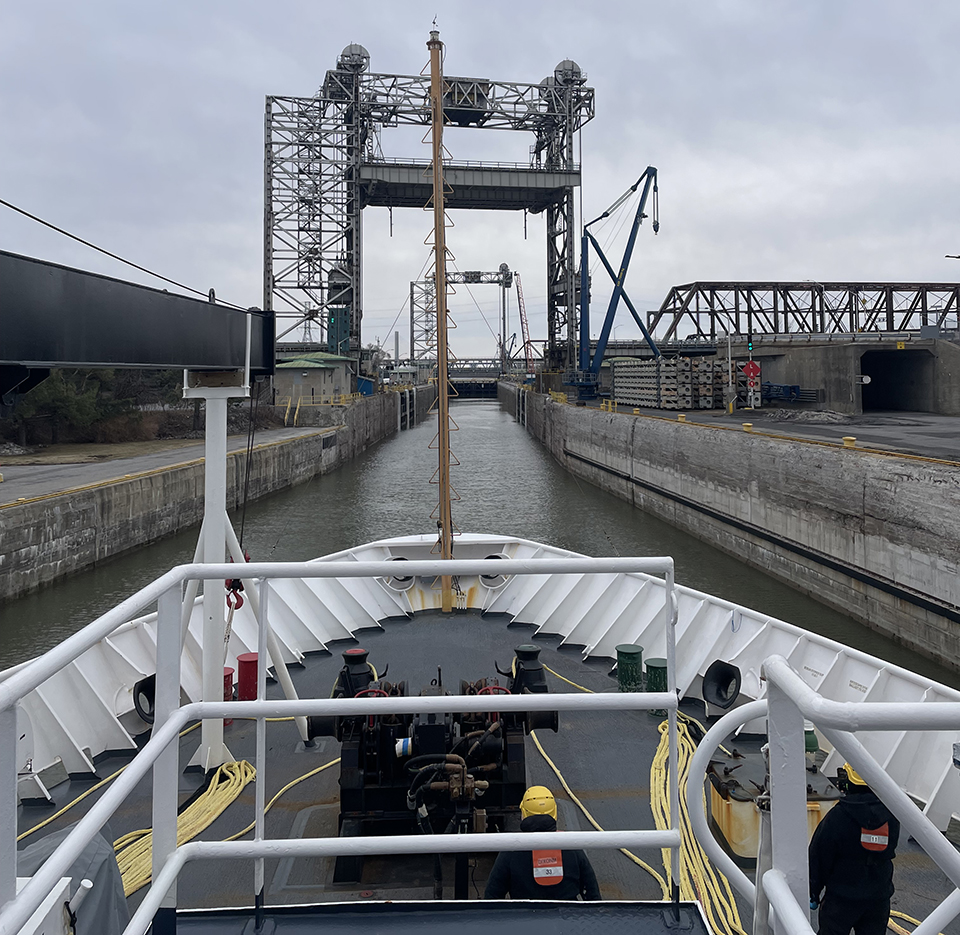
Image context: the cover uses NOAA's real photograph of Thomas Jefferson entering Saint Lambert's Lock on its way toward the Great Lakes. That is the right visual here because the event is not a policy speech or a laboratory result. It is a field season that starts with moving a survey ship and its equipment into position for months of hydrographic work.[1]
Fact file
| Item | Verified now | Confidence note |
|---|---|---|
| Current move | NOAA said on May 6, 2026 that Thomas Jefferson is back in the Great Lakes for the first time since 2022.[1] | Direct from NOAA's current field-season update. |
| Main 2026 work areas | NOAA says the ship will map western and central Lake Erie and eastern Lake Ontario this year.[1] | Direct from NOAA's current update. |
| Regional mapping gap | NOAA said on March 30, 2026 that about 83% of the Great Lakes still lack modern high-resolution bathymetric mapping.[2] | Direct from NOAA's mapping-gap explainer. |
| Why Lake Erie stands out | NOAA says western Lake Erie is one of the nation's busiest and shallowest waterways and that some surveys there still date to the 1940s.[2][3] | Strong; repeated across NOAA planning materials. |
| Survey methods | NOAA hydrographic units use multibeam echo sounders, side scan sonar, and lidar to produce bathymetry and detect dangers to navigation.[5] | Direct from NOAA equipment guidance. |
| Force multiplier | NOAA says the uncrewed surface vessel DriX can survey for up to four days at a time and cover shallow or constrained areas that complement ship operations.[1] | Direct from NOAA's current update. |
| Lake Ontario angle | NOAA says work in eastern Lake Ontario will also support charting around the Lake Ontario National Marine Sanctuary, an area with more than 1,300 square nautical miles and at least 41 known shipwrecks plus one aircraft wreck.[1][4] | Strong; direct from NOAA and sanctuary materials. |
What changed this week
The May 6 release did not announce a new law, a new funding line, or a dramatic accident.[1] Its significance is narrower and more practical. NOAA has opened a live survey season in places where old depth knowledge still governs real traffic. Coast Survey's 2026 planning material says the year's priorities were built from requests by pilots, port authorities, the U.S. Coast Guard, state agencies, and the boating community.[3] That point matters because it means the ship's route is not ceremonial. It reflects a queue of unresolved operational demand.
The strongest example is western Lake Erie. NOAA's March mapping explainer describes it as one of the busiest shallow-water corridors in the country and says modern surveys are needed there both because the area changes and because chart baselines in some sections remain old.[2] In other words, this is not only a scientific mapping project. It is basic infrastructure maintenance for a commercial waterway that still carries ore, grain, fuel, general cargo, ferries, tugs, fishing traffic, and recreational traffic across shallow bottoms and crowded approaches.
That is why Thomas Jefferson's return matters now. Field seasons are finite. A ship in the right lake during the right weather window can reduce backlog. A missed season leaves pilots and chart users leaning for another year on older assumptions.
Why the technology matters more than the ship name
NOAA's own equipment guidance makes clear that hydrographic surveying is a layered data operation, not a single-beam depth check.[5] Multibeam echo sounders map wide swaths of bottom and generate dense bathymetry; side scan sonar improves object detection for wrecks, obstructions, and other dangers; lidar extends measurement into nearshore spaces that are hard or unsafe for vessels to cover efficiently.[5] That is the technical spine of why a 2026 Great Lakes season can materially change chart quality rather than merely confirm what mariners already knew.
The additional reason to watch this season is DriX, the uncrewed surface vessel sailing with Thomas Jefferson.[1] NOAA says the platform can operate for up to four days before routine checks and refueling and can accelerate mapping work in shallow or logistically awkward areas.[1] In a place like western Lake Erie, where shallow water and coverage demand both matter, that is not gadget theater. It is a throughput tool.
The technical point is easy to miss in a photo-heavy release. NOAA is not merely sending a ship because a ship looks official. It is sending a ship-plus-sensors package intended to update bottom models, improve charted depths, and identify objects or changes that matter to safe navigation.[1][5]
Why eastern Lake Ontario is part of the same story
Lake Erie carries the urgent chart-age argument, but eastern Lake Ontario broadens the purpose of the mission. NOAA says this year's work will also support the Lake Ontario National Marine Sanctuary.[1] The sanctuary's own page says the protected area covers more than 1,300 square nautical miles and preserves a remarkably intact concentration of historic wrecks.[4] That brings a second rationale into view: good hydrography is not only about moving ships efficiently. It also underpins wreck documentation, sanctuary management, and habitat understanding.
That dual role shows up again in NOAA's Great Lakes Restoration Initiative work. The agency's coastal-management program describes collaborative benthic habitat mapping as a way to fill bathymetric and substrate gaps for restoration and ecosystem decisions across Great Lakes waters.[6] So the 2026 season sits at the overlap of commerce, safety, archaeology, and habitat science. That overlap is one reason the article should not be reduced to a generic "survey ship returns" brief.
What is still unresolved
The return of Thomas Jefferson does not mean the Great Lakes mapping deficit is about to disappear. NOAA's own number, 83% unmapped to modern high-resolution standard, is too large for one ship and one season to solve.[2] The realistic test is smaller: whether this campaign can retire specific shallow-water uncertainties, improve critical approaches, and create cleaner baselines for later work.
There is also an execution question. Survey seasons depend on weather, water conditions, equipment uptime, and the tradeoff between large-area coverage and detailed follow-up on hazards or interesting features. DriX can increase coverage, and multibeam or side scan systems can improve detail, but those tools still need time on task.[1][5] The practical risk is not that NOAA lacks the right explanation for why the work matters. The practical risk is that backlog remains larger than available field time.
What to watch next
In the next 30 days, watch NOAA field updates for evidence that the campaign is progressing from transit and setup into actual sounding accumulation in Lake Erie and Lake Ontario.[1][3]
In the next 90 days, watch for charting or survey-status notes that identify which approaches or sectors are being cleared first. That will show where stakeholders judged the biggest navigation payoff to be.[3]
Over the rest of the 2026 season, the key question is whether NOAA can turn an attention-grabbing Great Lakes return into measurable chart modernization in the shallowest, busiest parts of the system.[1][2][5] If it can, this will look like a quiet infrastructure story that paid off. If it cannot, the region will still be carrying too much modern traffic across too much legacy bottom knowledge.
Sources
- NOAA National Ocean Service, "NOAA Ship Thomas Jefferson returns to the Great Lakes" (May 6, 2026).
- NOAA Office of Coast Survey, "U.S. continues to close mapping gaps on ocean, coastal, and Great Lakes waters" (March 30, 2026).
- NOAA Office of Coast Survey, "Current Year Survey Plans" (accessed May 10, 2026).
- NOAA National Marine Sanctuaries, "Lake Ontario National Marine Sanctuary" (accessed May 10, 2026).
- NOAA Office of Coast Survey, "Hydrographic Survey Equipment" (accessed May 10, 2026).
- NOAA Office for Coastal Management, "Great Lakes Restoration Initiative" (accessed May 10, 2026).